Contact
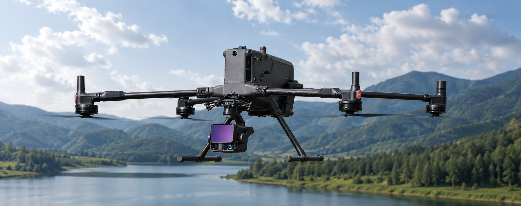
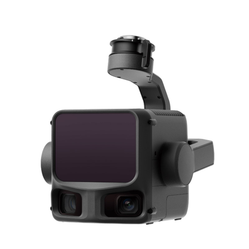
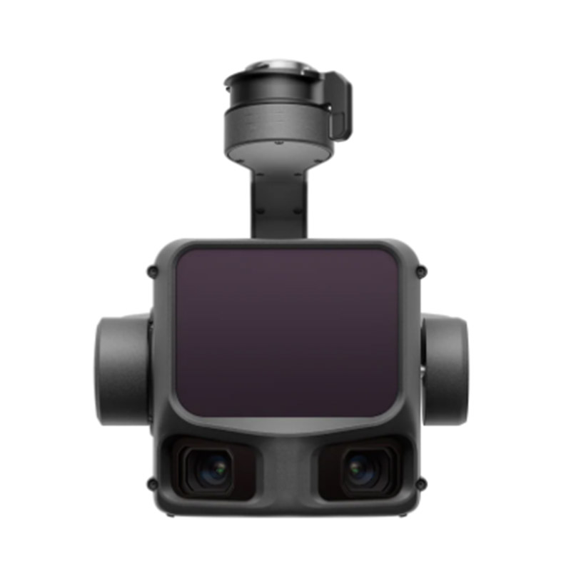
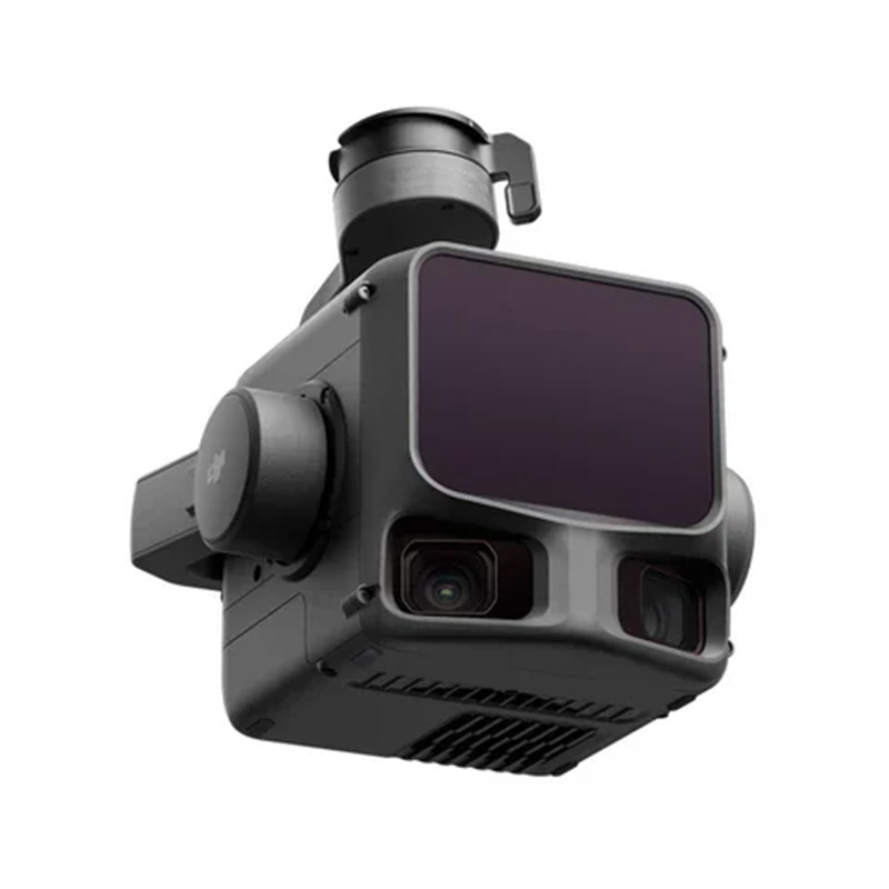
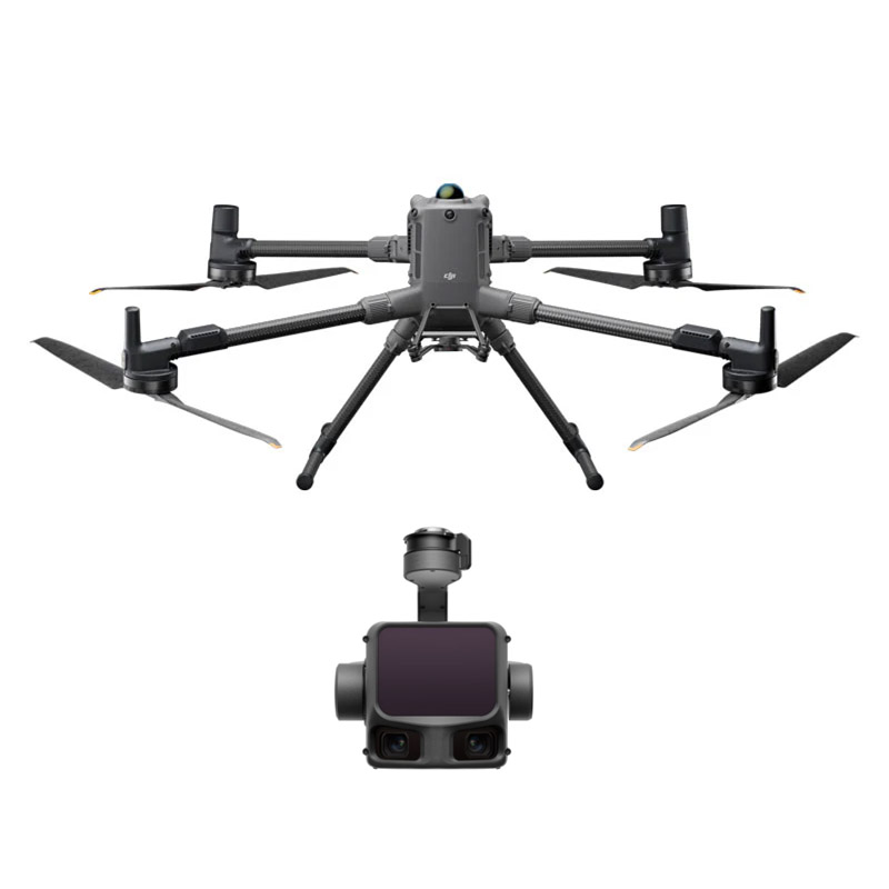
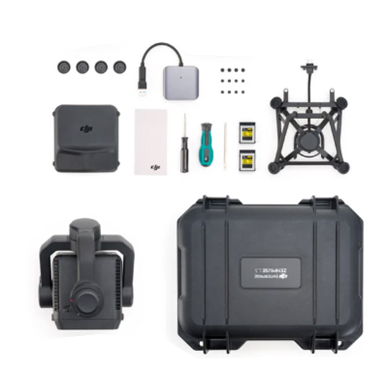
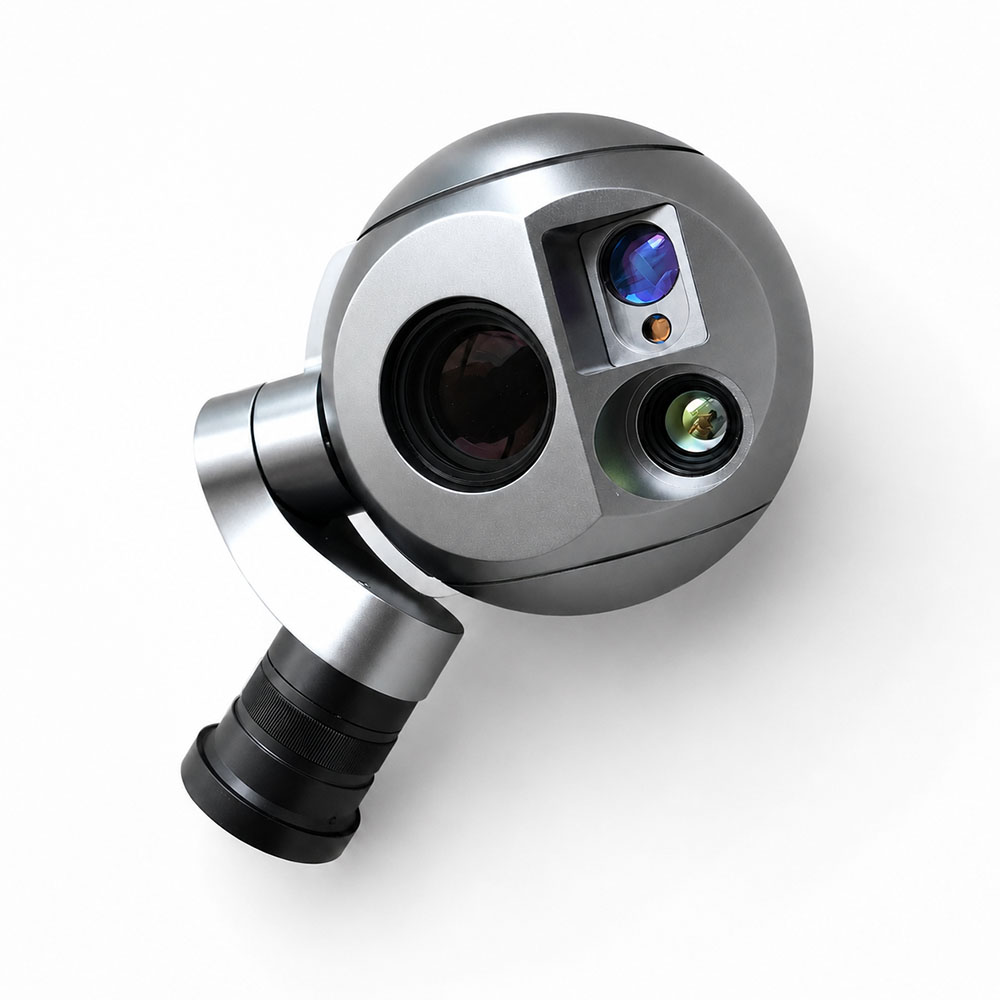
ZAi-L3 Gimbal LiDAR Camera

Key Highlights of ZAi-L3 Drone LiDAR Camera

Key Highlights of ZAi-L3 Drone LiDAR Camera
Long detection range up to 950m
Ultra-fine spot size with 0.25 mrad beam divergence
High pulse rate up to 2 million pulses/sec
Up to 16 returns per pulse for dense vegetation penetration
Dual 100 MP RGB cameras with 107° combined horizontal FOV
IP54 weather resistance for harsh operating environments
High survey precision with 3 cm vertical accuracy at 120 m_copy20260720181506

Start Mapping with ZAi-L3

The zenmuse L3 is a high-precision airborne LiDAR system designed for demanding surveying and mapping missions. Featuring a 1535 nm laser, dual 100 MP RGB cameras, and up to 16 returns, it delivers exceptional canopy penetration and survey-grade 3 cm accuracy, ensuring unmatched efficiency across vast terrains.

dji zenmuse l3
dji lidar camera
drone lidar camera
lidar payload for dji m400
dji zenmuse l3 camera payload kit

Key Benefits of ZAi-L3 UAV Gimbal Camera

Extended Operational Range

The 1535 nm laser achieves detection up to 950 meters, enabling high-altitude flights between 300 and 500 meters.

High-Precision Accuracy

Delivers 3 cm vertical accuracy at 120m, supported by an IMU with 0.01° roll and pitch precision.

Superior Canopy Penetration

Features 0.25 mrad beam divergence and 16 returns, piercing dense vegetation to capture ground points and thin wires.

Dual 100 MP Imaging
Dual 100 MP Imaging

Integrates dual Micro 4/3 CMOS sensors with 107° combined FOV for true-color point clouds and high-res photogrammetry.

High Pulse Rate & Coverage

Fires up to 2 million pulses per second, covering up to 10 km² per flight or 100 km² daily.

Survey-Grade POS & Workflow

Provides instant-on POS initialization, 200 Hz updates, and seamless end-to-end processing with DJI Terra for automated workflows.

ZAi-L3 Aerial LiDAR Payload Specifications

Specifications & System Parameters

Parameter

Specification
Dimensions192 × 162 × 202 mm
WeightApprox. 1.60 kg (excluding single gimbal connector)
Power ConsumptionTypical: 64 W; Max: 100 W
IP RatingIP54 (IEC 60529 Standard)
Operating/Storage Temperature

Operating: -20° to 50° C (-4° to 122° F)

Storage: -40° to 70° C (-40° to 158° F)

Supported StorageCFexpress™ Type B Card (Standard 1TB recommended)


LiDAR Module

ParameterSpecification


System Accuracy

At 120m Flight Altitude: Vertical: 3 cm, Horizontal: 4 cm (RMSE)

At 300m Flight Altitude: Vertical: 5 cm, Horizontal: 7.5 cm (RMSE)

Point Cloud Thickness

1.2 cm @ 1σ (120m altitude, orthophoto)

2.0 cm @ 1σ (300m altitude, orthophoto)

Laser Wavelength1535 nm


Max Detection Range

• 700 m @ 10% reflectivity, 350 kHz

• 950 m @ 10% reflectivity, 100 kHz

• 2000 m @ 80% reflectivity, 100 kHz

Pulse Rate100 kHz / 350 kHz / 1000 kHz / 2000 kHz
Max Returns Supported4 / 8 / 16 returns (depends on pulse frequency configuration)
Scanning ModesLine Repetitive Scan, Star Pattern Repetitive Scan, Non-repetitive Scan


Field of View (FOV)

• Line Scan: Horizontal 80°, Vertical 3°

• Star Pattern / Non-repetitive: Horizontal 80°, Vertical 80°

Spot SizeΦ 41 mm @ 120 m, Φ 86 mm @ 300 m (1/e²)
Ranging AccuracyAbsolute Accuracy: ±10 mm; Repeatability: < 5 mm (1σ)


Mapping Camera

ParameterSpecification
Sensor4/3 CMOS (Dual 100 MP Visible Light Camera)
Photo Resolution100 MP (12288 × 8192) / 25 MP (6144 × 4096)
Lens

Format Equivalent: 28 mm

FOV: 73.3° (Diagonal) / 62° (Horizontal) / 41.2° (Vertical)


Aperture & Shutter

• Aperture: f/2.0 to f/11

• Mechanical Shutter: 2 to 1/2000 s (500,000 cycles shutter life)

• Electronic Shutter: 2 to 1/16000 s

Min Shooting Interval25 MP (JPEG): 0.5 s; 100 MP (JPEG): 1.0 s; RAW: 1.2 s
Video ResolutionMP4 (H.265), Up to 4K @ 30fps


Inertial Navigation System (POS)

ParameterSpecification
Attitude AccuracyYaw: 0.02°, Pitch/Roll: 0.01° (Post-processing 1σ)
Positioning Accuracy (RTK)Horizontal: 1.0 cm + 1 ppm; Vertical: 1.5 cm + 1 ppm
Data Update RateGNSS: 5 Hz; POS Update: 200 Hz


Technical Consultation & Project Requirements

Share your mission specifications—such as payload capacity, endurance needs, or environmental constraints. Our engineering team will review your data and provide a optimized UAV configuration tailored to your industrial workflow.

HongKong Global Intelligence Technology Group Limited
+86-18818709844
aric@industrial-gradedrone.com
Flat/RM 871, 8/F, South Seas Centre, 75 Mody Road, Tsim Sha Tsui, Kowloon, Hong Kong, China
Contact Us
Contact
aric@industrial-gradedrone.com
+86-18818709844
Flat/RM 871, 8/F, South Seas Centre, 75 Mody Road, Tsim Sha Tsui, Kowloon, Hong Kong, China
aric@industrial-gradedrone.com +86-18818709844
We use cookies on this site, including third party cookies, to delivery experiennce for you.
Reject Cookies
Accept Cookies
Read Privacy Policy