A Deep Industry Perspective on Avalanche, Rockfall, Glacier Instability, and UAV-Powered Early Warning
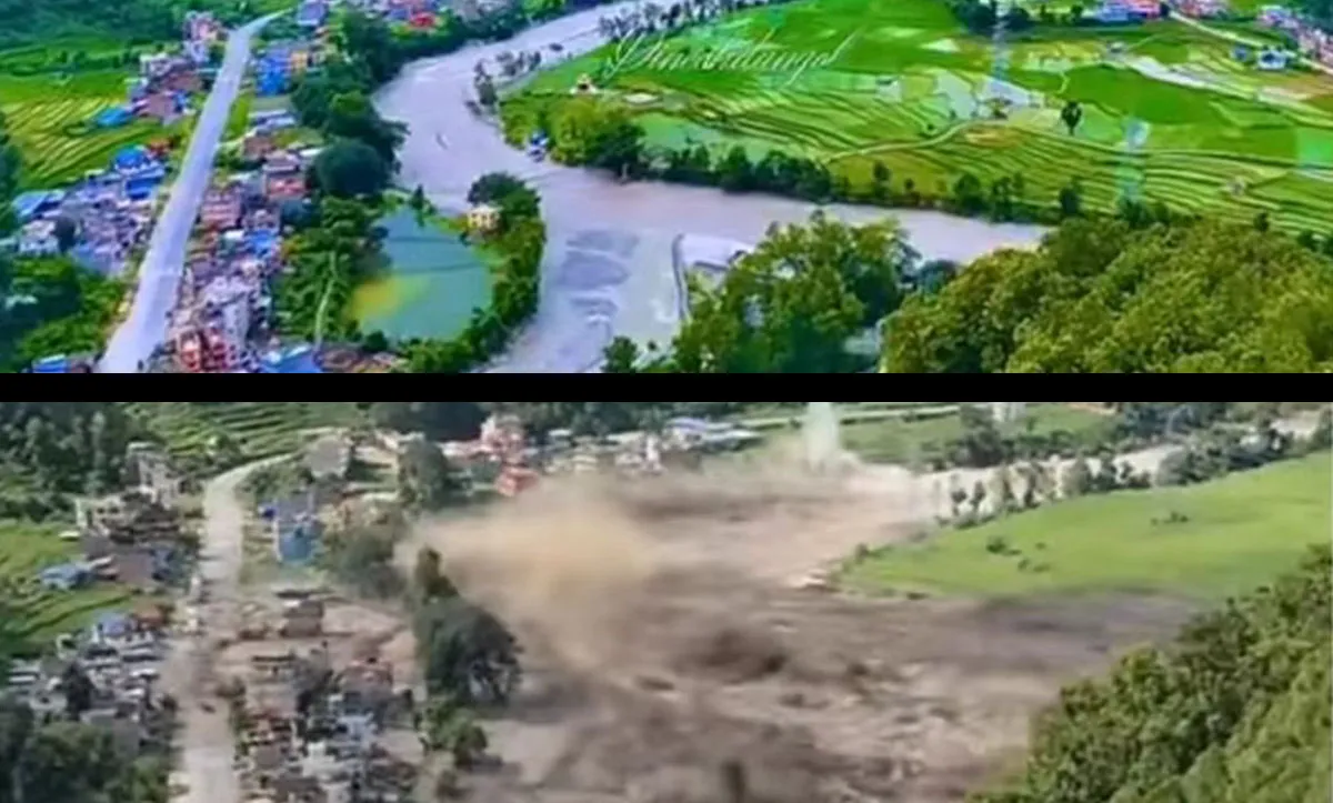
On August 26, 2026, a catastrophic flash flood swept through Nepal's Rasuwa district and the wider Bhote Koshi–Trishuli river corridor near the Nepal–China border (from CCTV News).
What initially appeared to be a devastating mountain flood was soon recognized as something far more complex: a cascading high-altitude hazard involving a large ice-and-rock collapse, debris movement, river disruption, and an extremely rapid downstream flood surge.
The event offers a sobering lesson for mountain communities around the world.
In high-altitude environments, the most dangerous disaster is often not a single landslide, avalanche, or flood. It is the chain reaction between them.
The initial collapse may occur thousands of meters above the valley floor, far beyond the reach of conventional monitoring teams. Minutes later, ice, rock, water and sediment can combine into a destructive debris flow that accelerates through narrow valleys. A temporary blockage can then create another hazard: a rapidly forming lake capable of producing a second flood.
Satellite imagery and seismic analysis have provided important clues about the Nepal event. Researchers from the Center for Land Surface Hazards reported that the flood likely began with a large ice avalanche associated with glacier collapse, with the resulting flood traveling through the Lhende Khola–Bhote Koshi–Trishuli river system at exceptional speed. At Galchhi, approximately 50 km downstream, the Trishuli River reportedly rose by around nine meters in only 30 minutes.
The tragedy therefore raises a critical question for the future:
How can authorities monitor unstable high-altitude terrain when the places most likely to fail are precisely the places humans can least safely reach?
This is where a new generation of intelligent UAV systems can become an important layer of the disaster early-warning architecture.
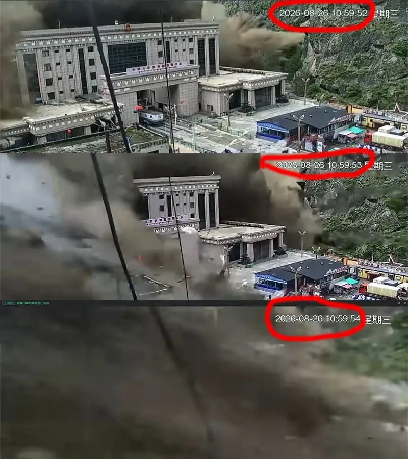
In a split-second, three-second nightmare, the murderous Nepalese debris flow slammed into China's Gyirong Port, effortlessly crushing a fortress built to survive magnitude-8 earthquakes like a fragile house of cards. (Screenshots from security footage circulating online)
The Nepal disaster should not be viewed simply as another monsoon flood.
Its significance lies in the interaction between the cryosphere, mountain geology and river system.
Available satellite and seismic evidence indicates that a major collapse occurred in the high-altitude source region before the downstream flood developed.
The seismic signal was initially interpreted as an earthquake. Subsequent analysis by the U.S. Geological Survey concluded that the seismic energy was generated by a glacial collapse and debris movement rather than a conventional tectonic earthquake. The event was characterized as a magnitude 5.2 landslide/debris-avalanche event, the U.S. Geological Survey confirmed.
This distinction matters.
A conventional earthquake early-warning system is designed primarily around seismic waves generated by tectonic rupture. A glacier or rock collapse creates a fundamentally different hazard sequence:
slope instability → ice/rock collapse → impact → debris mobilization → river blockage or surge → downstream flooding.
The initial trigger may therefore occur outside the monitoring logic of a conventional flood-warning network.
Once a large mass of ice, rock and sediment enters a steep Himalayan valley, gravity rapidly transforms the event.
The resulting flow can contain:
fractured rock;
glacier ice and snow;
water;
fine sediment;
boulders and construction debris.
Instead of behaving like ordinary river water, this mixture can behave more like a highly concentrated debris flow.
The extreme topographic gradient of Himalayan valleys further accelerates downstream propagation.
The August 2026 event reportedly traveled through the Lhende Khola–Bhote Koshi–Trishuli system at speeds estimated to reach approximately 75 km/h in some sections. At Galchhi, the river level increased by approximately nine meters within 30 minutes.
That leaves an extremely narrow window for conventional warning systems.
The first flood is not necessarily the end of the disaster.
Large volumes of rock, ice and sediment can temporarily block a mountain river, creating a rapidly developing impounded lake.
Satellite observations following the Nepal event identified newly forming water bodies associated with river blockage in the upper basin. Researchers warned that additional flooding could occur if these temporary barriers failed, particularly under continuing rainfall.
This creates a dangerous feedback loop:
Collapse → debris flow → river blockage → temporary lake → dam failure → secondary flood.
In other words, the disaster can continue evolving even after the original avalanche or collapse has stopped.
The Nepal event exposes a fundamental weakness in traditional mountain monitoring.
The problem is not simply a lack of sensors.
It is a problem of sensor accessibility, spatial coverage, survivability and response time.
Potential failure zones may exist above 5,000 meters, on glaciers, unstable cliffs or steep rock faces.
Field teams cannot continuously patrol these areas.
Even when engineers can reach them, weather, altitude, avalanches, rockfall and rapidly changing terrain create unacceptable operational risks.
Mountain valleys create severe line-of-sight limitations.
A sensor installed on one side of a valley may have little visibility into a concealed glacier face or unstable slope behind a ridge.
This is particularly problematic when the hazard source is located outside the immediate river monitoring network.
A conventional river gauge can measure rising water levels.
But if the monitoring station is located directly inside the flood corridor, it may be destroyed before downstream communities can receive meaningful warning.
The Center for Land Surface Hazards reported that some automatic flood-monitoring stations in the upper Trishuli system were overwhelmed or swept away during the August 2026 event.
Satellite remote sensing remains indispensable for large-scale disaster monitoring.
But mountainous regions frequently experience cloud cover, particularly during monsoon periods.
Satellite systems provide exceptional regional visibility, yet they cannot always provide the combination of low-altitude flexibility, rapid deployment and repeated close-range observation required for a rapidly evolving slope hazard.
This creates an important technological gap.
And that gap is increasingly being filled by UAVs.
A modern disaster-warning architecture should not rely on a single technology.
Instead, it should combine:
Satellite + Ground Sensors + UAV + AI Analytics + Emergency Communications
Within this architecture, drones can serve as the mobile sensing layer between satellites and ground infrastructure.
They can be deployed when satellite data identifies a potential anomaly, or when ground sensors detect unusual movement.
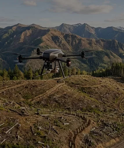
A professional UAV equipped with LiDAR and high-resolution imaging can repeatedly survey unstable mountain slopes.
Instead of relying only on visual inspection, operators can compare three-dimensional terrain models collected at different times.
This can reveal:
glacier-front retreat;
surface deformation;
expanding cracks;
rock-face displacement;
changes in debris accumulation;
unstable boulder zones;
altered drainage channels.
The objective is not to “predict the exact second of an avalanche.”
That remains extremely difficult.
The practical objective is to identify changing conditions and escalating risk before a catastrophic failure occurs.
This is a crucial distinction in professional disaster management.
When a collapse occurs, the priority changes from long-term monitoring to rapid situational awareness.
A UAV can be deployed from a safe staging area to inspect:
the collapse source;
blocked rivers;
newly formed lakes;
damaged bridges;
isolated communities;
unstable slopes;
potential secondary landslides.
This allows emergency commanders to see conditions without sending personnel directly into a potentially unstable disaster zone.
One of the most valuable roles of UAV intelligence is secondary-hazard assessment.
A valley that appears flooded may still contain:
unstable slopes;
temporary dams;
hidden landslide masses;
newly formed lakes;
damaged hydropower structures.
Drone missions can therefore continue after the initial flood, creating an evolving three-dimensional picture of the terrain.
The future of disaster UAVs is not simply about putting a better drone camera on a larger aircraft.
The real transformation is the integration of multiple sensing technologies.
LiDAR-equipped drones can generate dense three-dimensional point clouds of complex terrain.
For glacier and landslide monitoring, this enables teams to compare terrain models over time and quantify changes in:
elevation;
slope geometry;
debris volume;
erosion;
excavation;
accumulation.
The newer Zenmuse L3, for example, provides long-range LiDAR capability and can be integrated with the ZAi-M400 platform. DJI specifies a detection range of up to 950 m under its stated test conditions for low-reflectivity targets, with longer ranges possible under high-reflectivity conditions.
This is particularly valuable when the operator needs to maintain a safer standoff distance from an unstable cliff or glacier face.
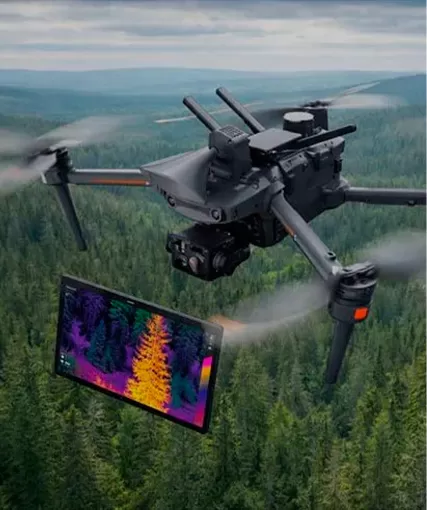
Thermal sensors provide another layer of information.
During emergency response, thermal imaging can help identify:
human heat signatures;
warm equipment;
active fires;
temperature anomalies;
potentially exposed infrastructure.
Combined with visual zoom, thermal imagery can help emergency teams investigate dangerous areas without immediately sending rescuers into them.
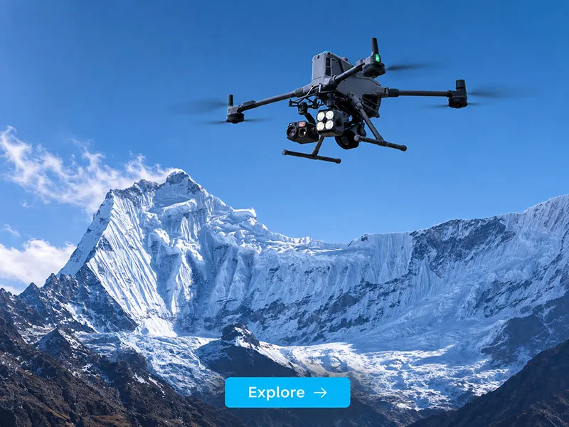
High-altitude valleys are among the most difficult environments for autonomous flight.
Terrain changes rapidly.
Power lines, cables, cliffs and ridgelines can become difficult to detect, particularly under low-light or poor-weather conditions.
The ZAi-M400 integrates rotating LiDAR, infrared sensing, omnidirectional vision and six-direction mmWave radar for obstacle sensing. The system is providing power-line-level obstacle detection capabilities.
For disaster operations, this is not merely a convenience.
It is a safety layer.
For complex mountain missions, the UAV platform must do more than fly.
It needs to carry different sensors, remain operational in difficult environments, communicate reliably and support extended missions.
The ZAi-M400 is particularly relevant because its platform architecture is designed around these requirements.
According to its specifications, the aircraft has:
up to 59 minutes of maximum flight time under specified test conditions;
up to 6 kg maximum payload at sea level;
7,000 m maximum takeoff altitude;
IP55 environmental protection;
operating temperatures from -20°C to 50°C;
integrated LiDAR and mmWave radar sensing;
support for multiple enterprise payloads.
An important operational qualification is that the 6 kg maximum payload is measured under sea-level conditions and payload capacity decreases as altitude increases. Therefore, high-altitude missions must be planned according to actual aircraft performance, payload mass, temperature, wind and air density rather than simply using the headline payload figure.
That distinction is particularly important when designing real Himalayan operations.
Identify terrain changes and potential instability before a major collapse.
The UAV can survey inaccessible glacier fronts, rock walls and debris zones while maintaining a safer operational distance.
Repeated LiDAR missions can generate comparable 3D terrain datasets.
By comparing historical and current models, geological teams can investigate:
Where is the terrain changing?
How rapidly is it changing?
Which areas are accumulating unstable material?
Has the geometry of a potential failure block changed?
The resulting data can support geologists and disaster-management authorities in prioritizing high-risk zones.
Monitor a newly formed blockage before it develops into a secondary flood hazard.
After an avalanche or landslide, a UAV can rapidly inspect the affected river corridor.
Operators can remotely assess:
water level;
lake expansion;
dam geometry;
overflow channels;
erosion;
downstream infrastructure.
Repeated missions can establish whether the temporary lake is stable, expanding or approaching a critical condition.
The key value is not simply obtaining photographs.
It is turning an inaccessible hazard into a measurable, time-series dataset.
Maintain aerial situational awareness when mountain terrain disrupts communication.
The ZAi-M400 supports airborne relay functionality, allowing one M400 to act as a relay aircraft for another M400 under supported operating conditions. DJI also specifies O4 Enterprise Enhanced Video Transmission and airborne relay capabilities for the platform.
This creates a potential two-aircraft operational architecture:
High Ground → Relay UAV → Forward UAV → Disaster Zone
The relay aircraft can remain in a more favorable position while the forward aircraft investigates areas hidden behind ridges or inside narrow valleys.
For emergency commanders, this can significantly improve operational visibility.
It can also reduce the need to place communication personnel directly inside unstable terrain.
It is tempting to describe drones as an “early-warning solution.”
But the more technically accurate concept is continuous risk awareness.
A drone cannot guarantee that an avalanche will be predicted minutes before it happens.
Geological systems are too complex for such certainty.
What UAV technology can do is continuously improve the information available to decision-makers.
Imagine a high-altitude disaster monitoring network operating like this:
Detect regional glacier, snow, land-surface and water-body changes.
Monitor seismic activity, rainfall, river levels and local deformation.
Deploy drones when an anomaly requires high-resolution inspection.
Convert the hazard zone into measurable 3D and thermal data.
Compare historical datasets and identify abnormal changes.
Geologists and emergency authorities determine whether intervention or evacuation is required.
Deploy UAVs for reconnaissance, communications, search and rescue, and logistics support.
This is where the concept of the low-altitude intelligent network becomes meaningful.
The drone is no longer an isolated aircraft.
It becomes one node in a larger disaster-intelligence infrastructure.
The lesson from Nepal extends far beyond the Himalayas.
Mountain communities across the world face similar combinations of climate change, glacier retreat, permafrost degradation, unstable slopes and increasing infrastructure exposure.
Potentially vulnerable regions include:
the Alps in Europe;
the Andes in South America;
the Caucasus;
the Rockies and other North American high mountain regions;
the Hindu Kush–Himalaya region.
The physical mechanisms differ from one mountain system to another.
But the fundamental problem is similar:
Critical hazards are often located where humans cannot safely maintain continuous observation.
Climate change adds another layer of uncertainty.
Warming temperatures can alter glacier geometry, snow conditions, permafrost stability and hydrological processes. This does not mean every glacier is destined to collapse. But it does mean that historical assumptions about mountain stability can no longer be treated as permanently reliable.
The future therefore requires more adaptive monitoring.
The Nepal disaster also demonstrates that natural hazards do not respect national borders.
A landslide or glacier collapse can begin on one side of a mountain range and affect communities, roads, hydropower infrastructure and tourism routes in another country within minutes.
That makes cross-border data sharing increasingly important.
A mature high-altitude disaster system should combine:
Satellite remote sensing
Seismic monitoring
Meteorological data
River-level sensors
Glacier observation
UAV reconnaissance
AI-based change detection
Cross-border emergency communication
The objective should not be to replace existing warning systems.
It should be to connect their blind spots.
The greatest value of enterprise drones is realized before the disaster.
A drone deployed after a flood is valuable.
A drone deployed weeks, months or years earlier to understand the terrain is potentially far more valuable.
This suggests a new operational cycle:
Repeatedly survey high-risk terrain.
Identify abnormal deformation or environmental changes.
Deploy UAVs for close-range LiDAR, visual and thermal inspection.
Combine UAV observations with satellite, seismic and hydrological information.
Provide authorities with actionable risk information.
Deploy drones immediately when a disaster occurs.
Continue aerial monitoring for secondary hazards.
This transforms UAVs from emergency-response tools into long-term resilience infrastructure.
The August 26, 2026 Nepal disaster is a painful reminder that the most dangerous mountain disasters are increasingly defined by cascading processes rather than isolated events.
An ice or rock collapse can trigger a debris avalanche.
The debris can transform a river.
The river can create a temporary lake.
The lake can generate another flood.
And the entire chain can cross national borders before conventional response systems have time to react.
No single technology can eliminate this risk.
But a combination of satellite observation, ground sensing, geological analysis, intelligent UAVs and rapid emergency communications can significantly improve humanity's ability to see what is happening in places that were previously too dangerous, too remote or too difficult to monitor continuously.
This is where the next generation of enterprise drones becomes strategically important.
Platforms such as the ZAi-M400, when combined with LiDAR, thermal imaging, high-resolution optical sensors and intelligent communications, can serve as mobile aerial sensing nodes within a broader disaster-intelligence network. Its 7,000 m maximum takeoff altitude, 59-minute maximum flight time under specified conditions, multi-payload architecture, integrated sensing and airborne relay capabilities make it a strong candidate for demanding emergency and geospatial missions—while real-world high-altitude operations must always account for reduced payload capacity, weather, wind, battery performance and local aviation regulations.
For HongKong Global Intelligence Technology Group Limited, the future of low-altitude intelligence is not simply about making drones fly farther.
It is about making them see earlier, measure more accurately, communicate more reliably and help people make better decisions before the next disaster becomes irreversible.
The goal is not to predict every avalanche.
The goal is to build a world in which fewer people are caught unaware when the mountain moves.
Technology cannot stop a glacier from collapsing.
But better intelligence can give people more time to move out of its path.


 English
 français
 Deutsch
 русский
 فارسی
فارسی ไทย
ไทย العربية
 Nederland
 বাঙালি
 Македонија