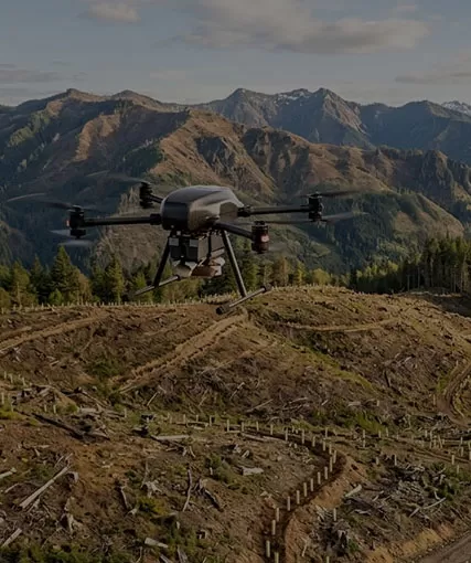
Commercial drones have developed from simple aerial cameras into configurable business systems used for surveying, infrastructure inspection, public safety, agriculture, logistics, environmental monitoring and industrial asset management. The aircraft is only one part of the investment. Payload sensors, flight-control software, data processing, batteries, training, regulatory approval, maintenance and after-sales support often determine whether a drone program creates measurable value.
For business buyers, the central question is not “Which drone has the best specifications?” It is “Which drone can complete our mission safely, repeatedly and at an acceptable cost per job?” A compact multirotor may be ideal for close inspection, while a fixed-wing platform may cover a large survey area more efficiently. A thermal camera can detect temperature differences, but it cannot replace LiDAR when the project requires precise three-dimensional geometry beneath partial vegetation. Heavy-lift platforms can transport larger payloads, but their operating permissions, safety planning and logistics are more demanding.
This guide explains the main types of commercial drones, their applications, current procurement price ranges, licensing considerations and the selection criteria businesses should use before requesting a quotation. It also shows how ZAi, the industrial drone brand of Hong Kong Global Intelligence Technology Group, approaches application-based configuration for mapping, inspection, security, cargo and other demanding operations.
Commercial drones are unmanned aircraft systems operated to support business, professional, governmental or organizational objectives rather than solely for personal recreation.A commercial drone system usually includes the unmanned aircraft, remote controller or ground station, batteries, charging equipment, payload, data link, navigation system, software, operating procedures and trained personnel. Depending on the mission, it may also include a docking station, RTK or PPK positioning equipment, cellular or satellite communication, parachute system, remote identification equipment and cloud-based fleet management.
The same aircraft can be recreational in one flight and commercial in another. A person filming a landscape for personal enjoyment is operating for recreation. The same person collecting imagery for a construction report, insurance claim, property listing or paid media project is performing a business-related operation and may be subject to different pilot, registration, insurance and authorization requirements.Businesses should define the operational purpose before purchasing. Aviation authorities generally regulate the flight based on risk, aircraft characteristics and operating conditions, not merely the name printed on the product box.
A consumer buyer may focus on camera resolution and flight time. A commercial buyer must consider whether the data can be converted into a report, map, measurement, maintenance decision or operational action. For example, a surveying project may require:
An aircraft capable of stable automated flight paths
A calibrated mapping camera or LiDAR payload
RTK or PPK positioning
Ground control or checkpoint procedures
Mission-planning and photogrammetry software
Coordinate-system management
Data-quality verification
Qualified pilots and survey professionals
This is why the price of a professional program can be several times the cost of the airframe. The business value comes from repeatable outputs rather than flight alone.
Drones can place sensors above difficult, dangerous or widely distributed assets without exposing workers to the same level of climbing, driving or manned-aircraft activity. They can also capture a consistent digital record that is compared over time.Potential benefits include shorter data-collection time, improved access, reduced disruption to operating facilities, better visual documentation and faster identification of anomalies. These benefits depend on a suitable workflow. A drone that collects more imagery than the company can process may increase workload rather than reduce it.
Commercial drone is the broader category. It includes relatively lightweight systems used for photography, real estate, media and small-area mapping as well as highly specialized industrial platforms. Industrial drones are normally configured for demanding workloads, heavier payloads, harsh environments, long-range communication, system integration or repeated professional use.Companies evaluating commercial drones should decide whether they need a general professional platform or an application-specific industrial system. The answer affects price, training, support, payload options and regulatory planning.
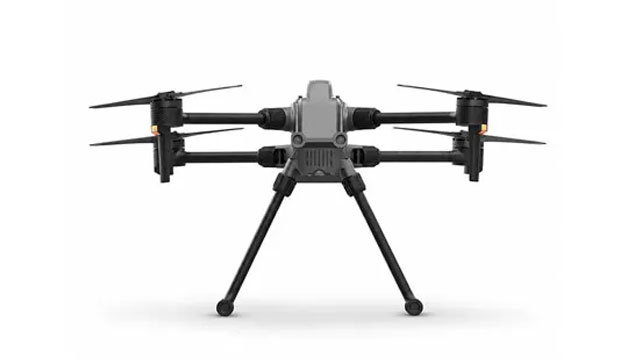
Commercial drones are commonly classified as multirotor, fixed-wing, hybrid VTOL, single-rotor, heavy-lift, tethered or autonomous dock-based systems according to their flight structure and mission profile.
| Drone Type | Main Strength | Main Limitation | Typical Business Uses | Best Selection Question |
|---|---|---|---|---|
| Multirotor | Vertical takeoff, hovering and precise close-range positioning | Shorter endurance than efficient fixed-wing aircraft | Inspection, photography, public safety, mapping and thermal surveys | Does the mission require hovering or close asset access? |
| Fixed-wing | Efficient coverage of large areas | Cannot hover and may require more launch or recovery space | Corridor mapping, agriculture, forestry and regional surveying | Is area coverage more important than stationary observation? |
| Hybrid VTOL | Vertical takeoff combined with fixed-wing cruise efficiency | Greater mechanical and control complexity | Large-area mapping, long corridors and remote-site operations | Does the site lack a runway but require long endurance? |
| Single-rotor helicopter | Longer endurance or heavier payload potential in selected designs | Higher mechanical complexity and more demanding safety procedures | Specialized inspection, spraying and heavy payload missions | Does the payload or endurance justify the operational complexity? |
| Heavy-lift multirotor | High payload capacity and accurate vertical positioning | High cost, short endurance under load and stricter operational planning | Cargo, equipment transport, emergency supply and specialized sensors | What is the payload mass after including mounting and safety equipment? |
| Tethered drone | Long-duration power and persistent observation | Restricted by tether length and ground equipment | Security, communications relay, traffic monitoring and events | Is persistent coverage more valuable than mobility? |
| Autonomous dock-based drone | Repeatable remote missions with automated charging or battery management | Requires communications, site installation and regulatory approval | Asset patrol, construction progress and recurring inspection | Can the mission be standardized enough for unattended deployment? |
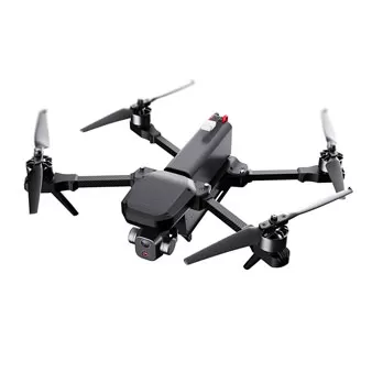
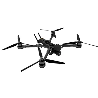
Quadcopters, hexacopters and octocopters are the most recognizable commercial platforms. They can take off vertically, hover, move slowly around structures and land in confined areas. These characteristics make them suitable for roofs, towers, bridges, solar arrays, public-safety scenes and small-to-medium mapping sites.More motors can provide payload capacity or redundancy, but they also add weight, energy consumption and maintenance points. A hexacopter is not automatically safer than a quadcopter; system architecture, flight controller, propulsion condition and emergency procedures must be assessed together.
Fixed-wing aircraft generate lift through forward movement and can cover more ground per battery than hovering aircraft of similar weight. They are widely used for large farms, mines, forests, coastlines and transport corridors.Traditional fixed-wing systems may use hand launch, catapult launch, belly landing, net recovery or runway operations. Buyers should evaluate whether the site has enough clear space and whether the payload can tolerate the selected recovery method.
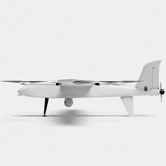
Hybrid vertical-takeoff-and-landing aircraft use rotors to take off and land, then transition to wing-borne flight. They combine site flexibility with longer-range coverage, making them useful for pipelines, power lines, railways and extensive surveys.Transition flight introduces additional control complexity. Businesses should review wind limits, transition reliability, emergency behavior and operator training rather than comparing endurance alone.
Heavy-lift drones are engineered to carry sensors, supplies, equipment or cargo beyond the payload capacity of standard camera drones. Payload ratings can range from several kilograms to tens of kilograms, while larger aircraft may fall outside small-drone regulatory frameworks.Payload capacity is normally quoted under defined altitude, temperature and battery conditions. Actual range and endurance decrease as payload increases. A 50-kilogram payload capability does not mean the aircraft can carry 50 kilograms for the same distance or duration as an unloaded test flight.
Autonomous systems use predefined missions, obstacle detection, remote communications and automated charging or battery exchange. They can inspect the same route daily or weekly and send data to a centralized platform.Autonomy does not remove legal responsibility. A business may still require remote-pilot supervision, operational authorization, detect-and-avoid procedures and emergency response. Regulations for beyond-visual-line-of-sight operations remain more demanding than ordinary visual-line-of-sight missions in many jurisdictions.
Commercial drones are used to collect aerial data, inspect assets, monitor conditions, carry payloads and support time-sensitive decisions across industries.
Mapping drones collect overlapping images or LiDAR measurements that can be processed into orthomosaics, point clouds, digital surface models and three-dimensional site models. Applications include topographic surveys, stockpile measurement, construction planning and land development.Camera mapping requires appropriate overlap, ground-sampling distance, lighting and positioning. LiDAR is useful where detailed geometry or partial vegetation penetration is required, but it introduces higher sensor and processing costs.A buyer selecting a land surveying drone should define the required horizontal and vertical accuracy, area per mission, terrain, coordinate system and deliverable format. The aircraft should be selected after these requirements are established.
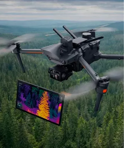
Drones inspect power lines, transmission towers, wind turbines, solar panels, bridges, roofs, flare stacks, pipelines and industrial plants. Visible cameras document surface condition, thermal sensors identify temperature anomalies and zoom cameras allow distant observation.Inspection quality depends on distance, viewing angle, sensor resolution and environmental conditions. A thermal image can indicate an abnormal temperature pattern, but interpretation should be performed by qualified personnel using appropriate reference conditions.
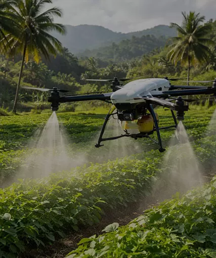
Agricultural drones support crop scouting, vegetation-index mapping, irrigation assessment, spraying and spreading. Forestry applications include canopy mapping, fire monitoring, wildlife observation and resource assessment.Spraying aircraft require particular attention to payload, droplet size, flow calibration, chemical compatibility, drift and local pesticide rules. Mapping and spraying are different missions and may justify different aircraft.
Police, fire departments, rescue teams and emergency managers use drones for situational awareness, search operations, thermal detection, traffic incidents and disaster assessment. Rapid deployment and secure communications may be more important than cinematic image quality.Public-safety programs need evidence-management procedures, privacy policies, pilot training, maintenance records and clear authority for each mission.
Construction teams use drones for progress documentation, site mapping, earthwork measurement, safety overview and comparison with design models. Mines and quarries use them for stockpile volume, pit mapping, haul-road monitoring and blast planning.Repeatability matters. Flying the same route with consistent ground control and processing settings produces more useful change data than occasional visually attractive flights.
Energy operators inspect solar farms, wind turbines, substations, oil-and-gas infrastructure and long linear assets. Operations may occur in electromagnetic, hazardous or remote environments, so platform suitability should be evaluated carefully.Explosion-risk areas, offshore platforms and high-voltage facilities may require specialized procedures or equipment approvals. A standard drone should not be assumed suitable merely because it can physically reach the asset.
Cargo drones can move medical supplies, tools, spare parts and small shipments where ground access is slow or difficult. The strongest use cases involve time-sensitive, high-value or geographically constrained deliveries rather than routine low-value transport.Businesses must calculate the complete route, reserve energy, alternate landing sites, communications coverage and loading process. Beyond-visual-line-of-sight operations and carriage of certain goods can require additional authorization.
Commercial photography remains an important use. Real-estate companies, production teams, tourism operators and event organizers use stabilized cameras for aerial media. Requirements include camera quality, lens options, smooth movement, noise and permissions around people or controlled airspace.
Commercial drones prioritize mission reliability, payload integration, data quality, fleet management and support, while consumer drones prioritize portability, ease of use and personal photography.
| Factor | Commercial Drone | Consumer Drone |
|---|---|---|
| Primary objective | Produce repeatable business data or complete a professional task | Personal photography, recreation and casual content creation |
| Payload | May support thermal, multispectral, LiDAR, zoom or custom sensors | Usually has an integrated fixed camera |
| Positioning | May include RTK, PPK, ground-control integration and high-precision logs | Standard GNSS is generally sufficient for navigation |
| Durability | Often designed for higher duty cycles and broader environmental conditions | Typically optimized for light, portable use |
| Software | Mission planning, fleet control, mapping, inspection or asset integration | Simple flight and media-editing applications |
| Support | Project configuration, documentation, training, parts and lifecycle service | Retail warranty and standardized accessories |
| Security | May require controlled data storage, encryption and enterprise account management | Designed mainly for individual user convenience |
| Price | Ranges from professional camera systems to custom six-figure programs | Commonly ranges from a few hundred to several thousand US dollars |
A consumer drone may advertise high video resolution and an impressive maximum range. A commercial inspection team may care more about thermal sensitivity, zoom stability, IP rating, encrypted data handling and replacement-part availability.Likewise, a professional mapping system may use a camera with fewer marketing features but a mechanical shutter, calibrated lens and RTK positioning. These characteristics can be more valuable than cinematic flight modes.
Commercial operations depend on spare batteries, propellers, payload mounts, firmware management, manuals and repair turnaround. A platform that is unavailable for a month can disrupt contracts even if its original purchase price was low.Businesses should ask how long the model will be supported, which parts are stocked, whether batteries are interchangeable and how firmware changes are controlled across a fleet.
When payload, weather, operating distance or integration requirements exceed the capability of general professional aircraft, buyers may need industrial drones configured for the project. ZAi presents its industrial platforms as application-driven systems for inspection, mapping, security and other complex operations rather than one standardized consumer product.
Commercial drone cost includes the aircraft, payload, control equipment, batteries, software, training, compliance, maintenance and data-processing tools required to perform the business mission.Prices vary widely, and many industrial systems are quotation-based. The following ranges are suitable for early budgeting rather than final procurement.
| Commercial Drone Category | Indicative 2026 Planning Range | Typical Included Capability | Common Extra Costs |
|---|---|---|---|
| Professional camera or basic mapping drone | Approximately US$1,500–US$6,000 | Integrated camera, automated flight and portable controller | Extra batteries, insurance, mapping software and pilot training |
| Enterprise inspection or RTK mapping system | Approximately US$5,000–US$20,000 | RTK positioning, zoom or thermal options and enterprise software | Base station, thermal payload, processing licenses and service plan |
| Professional LiDAR or advanced multisensor system | Approximately US$20,000–US$80,000+ | LiDAR, precision navigation, specialized payload and processing workflow | Survey software, calibration, training and high-performance computing |
| Agricultural spraying drone package | Approximately US$10,000–US$50,000+ | Spray or spread system, batteries, charger and mission controller | Generator, transport, chemical handling, licensing and spare pumps |
| Heavy-lift, cargo or custom industrial platform | Approximately US$25,000–US$150,000+ | High payload, custom integration and specialized control | Payload engineering, regulatory approval, ground equipment and testing |
| Autonomous dock-based program | Approximately US$25,000–US$100,000+ per deployment | Drone, dock, communications and remote operations software | Site construction, networking, authorization and recurring cloud fees |
These ranges can overlap. A premium cinema drone may cost more than a basic inspection drone, while a compact thermal system may cost less than a survey package with software and control points.
A business should budget at least the following categories:
Aircraft and payload
Two or more operational battery sets
Chargers, generators or battery stations
Controller, base station and communication equipment
Software licenses and cloud storage
Pilot certification and mission-specific training
Insurance and regulatory applications
Transport cases and field equipment
Maintenance, spare parts and replacement batteries
Data processing, analysis and report production
Suppose a complete mapping system costs US$24,000 and is expected to complete 240 billable projects over three years. Ignoring finance and operating expenses, the equipment capital allocation is US$100 per project:US$24,000 ÷ 240 projects = US$100 per project.The actual cost must also include pilot time, travel, processing, insurance, battery replacement and software. This calculation helps compare purchase with outsourcing.
A more expensive drone can reduce total cost if it covers more area, improves data accuracy, carries the required sensor without modification or reduces repeat visits. Conversely, paying for heavy payload or extreme range creates no value if the business performs only small visual inspections.
Commercial drone license requirements are the pilot, operator, aircraft-registration and operational-authority rules imposed by the jurisdiction where the drone is flown.There is no single worldwide commercial drone license. Requirements change by country, aircraft weight, risk category, airspace, proximity to people, flight altitude, visual-line-of-sight status and payload. Regulations also change over time, so businesses should verify official aviation-authority guidance before every new program or country deployment.
In the United States, most small commercial drone operations use the FAA's Part 107 framework for aircraft weighing less than 55 pounds, or approximately 25 kilograms. The remote pilot must hold an FAA Remote Pilot Certificate. First-time applicants must generally be at least 16 years old, meet language and fitness requirements and pass the aeronautical knowledge test.FAA certificate holders must complete online recurrent training within the previous 24 calendar months to maintain knowledge recency. Part 107 registration costs US$5 per drone and is valid for three years. Registered drones must comply with Remote ID unless an applicable exception, such as operation within an FAA-recognized identification area, applies.Part 107 operations are normally conducted at or below 400 feet above ground level, subject to airspace and obstacle rules. Controlled airspace may require authorization through LAANC or FAA DroneZone. Beyond-visual-line-of-sight operations and other activities outside standard rules may require a waiver or another approval pathway.
EASA rules classify operations by risk rather than by whether the flight is commercial. The Open category covers many lower-risk recreational and commercial missions. Open-category operations generally remain within visual line of sight, below 120 meters and within aircraft and operational limitations.The Open category is divided into A1, A2 and A3. Requirements depend on aircraft class and proximity to uninvolved people. For example, A2 operations with the appropriate class aircraft generally require a 30-meter horizontal distance from uninvolved people, which can be reduced to 5 meters when a compliant low-speed function is used.Operations that exceed Open-category limits may fall into the Specific category and require an operational authorization, declaration under a standard scenario where available, or an accepted risk assessment. The Certified category applies to the highest-risk operations.
The UK uses Open, Specific and Certified categories under its national framework. Businesses may need an organization Operator ID, while pilots may require a Flyer ID depending on aircraft weight and class. Current CAA guidance states that the organization responsible for the drone should register as the operator and label aircraft with the Operator ID.More advanced operations may require an Operational Authorisation. Businesses should check current UK class-mark and transitional arrangements because they are not identical to EU requirements.
Airspace authorization near airports or controlled zones
Permission from the landowner or asset owner
Local privacy and data-protection compliance
Insurance requirements
Radio-frequency or cellular communication rules
Permission for spraying, dropping objects or carrying dangerous goods
Environmental, wildlife or protected-area restrictions
Import, customs and product-certification requirements
Authorization for BVLOS or operations over people
Purchasing a capable aircraft does not create permission to use every capability. Businesses should complete a regulatory feasibility review before ordering a high-payload, long-range or autonomous system.
The key buying factors are mission output, payload, endurance, operating environment, regulatory feasibility, data workflow, support and lifecycle cost.
Begin with the business output: thermal anomaly report, orthomosaic, stockpile volume, security video, vegetation map, cargo delivery or live emergency view. The deliverable determines the payload, flight plan and processing software.
Confirm sensor weight, power demand, field of view, accuracy and data format. If the payload is removable, review mounting stiffness, vibration isolation, center of gravity and communication interfaces.
Maximum flight time is normally measured under favorable test conditions. Ask for expected endurance with the required payload, reserve policy, wind and operating temperature. A business plan should use safe mission time rather than the marketing maximum.
Range can mean radio-link distance, mission radius or total route length. Regulations may require visual line of sight even when the communication link reaches farther. Terrain, buildings and radio interference can reduce practical range.
Review wind resistance, operating temperature, precipitation rating, dust exposure and altitude performance. A written IP rating is more useful than a vague statement such as “all weather,” but even rated aircraft have operational limits.
RTK can provide centimeter-level positioning under appropriate conditions, but final survey accuracy also depends on camera calibration, flight height, satellite geometry, checkpoints and processing. Buyers should define acceptable deliverable accuracy rather than requesting RTK as a feature without a workflow.
Consider obstacle sensing, propulsion redundancy, battery monitoring, return-to-home logic, geofencing, parachute options and emergency landing behavior. Redundancy adds value only when failure modes and maintenance are understood.
Businesses handling infrastructure, government or personal data should evaluate storage location, encryption, user permissions, firmware control, offline operation and export formats. Cloud convenience must be balanced with contractual and regulatory requirements.
Ask for inspection intervals, propeller and motor replacement guidance, battery cycle management, repair turnaround and the expected support period. Batteries are consumable assets and should be included in lifecycle budgeting.
Industrial projects may require a custom payload, communication module, ground station, release mechanism or API integration. Confirm who is responsible for engineering, testing, documentation and regulatory implications.
The best commercial drone is the system that produces the required business result within the company's regulatory, technical and financial constraints.
Document the operating site, area, asset height, required data, frequency, weather, payload and delivery deadline. Avoid beginning with a brand or aircraft model.
Specify required payload capacity, useful endurance, accuracy, wind limit, operating temperature and communication needs. Separate mandatory requirements from preferences.
Check pilot qualifications, registration, airspace, BVLOS, operations over people and payload restrictions. If the desired mission cannot be authorized, changing the aircraft will not solve the problem.
Request quotations that include aircraft, payload, batteries, chargers, software, training, spares, shipping and service. Confirm whether prices include taxes, import duties and on-site commissioning.
Test the actual payload and a representative site where possible. Evaluate setup time, flight stability, data quality, battery change, software workflow and report production. A successful demonstration should produce the same deliverable expected in operations.
Look for application knowledge, configuration support, documentation, spare parts, training and communication after delivery. A supplier should be able to explain trade-offs rather than simply recommend the highest-priced model.ZAi describes its approach as application-driven configuration for inspection, mapping, security and other complex missions. The company supports commercial and industrial platforms, payload integration and project-based solutions through Hong Kong Global Intelligence Technology Group.
Include batteries, software renewals, pilot recurrency, insurance, repairs, transport and downtime. Compare the cost with outsourced services and the value of faster information.
Assign responsibility for pilots, maintenance, flight approval, data management, incident reporting and regulatory updates. The aircraft should enter service only after procedures and training are complete.
Industry and specific mission
Required payload or data deliverable
Payload weight and dimensions
Target flight time, distance and area coverage
Operating altitude, temperature, wind and weather
Visual-line-of-sight or BVLOS requirement
Country of operation and applicable approvals
Required positioning accuracy
Communication and data-security needs
Quantity, delivery schedule and training scope
Budget range and expected annual usage
Providing this information allows ZAi to recommend an airframe, payload, controller, communications package and support plan around the mission rather than issuing a generic drone quotation.
These FAQs answer common business questions about cost, licensing, endurance, payload, insurance and return on investment.
A drone is used commercially when it supports a business, paid service, organizational task or professional deliverable. The same aircraft may be recreational or commercial depending on the purpose of the flight.
A professional camera or basic mapping package may begin around US$1,500–US$6,000, while enterprise thermal, RTK and inspection systems commonly require US$5,000–US$20,000. LiDAR, heavy-lift and autonomous systems can cost tens of thousands to more than US$100,000.
Requirements depend on the country and mission. In the United States, most small commercial operations require an FAA Part 107 Remote Pilot Certificate. The EU and UK use risk categories, operator registration and competency requirements rather than one universal commercial license.
Many battery multirotors provide approximately 25–50 minutes under favorable conditions, while fixed-wing and hybrid systems may operate considerably longer. Payload, wind, temperature, battery reserve and aircraft condition reduce usable mission time.
BVLOS operations may be possible, but they generally require additional authorization, risk assessment, communications and operational controls. A long-range data link alone does not make BVLOS flight legal.
Compare the total cost of ownership with reduced inspection time, fewer site visits, avoided shutdowns, faster reporting, lower contractor cost or new revenue. Measure results per completed survey, inspection or delivery rather than per flight hour alone.
A successful commercial drone purchase aligns aircraft type, payload, data workflow, regulatory approval and supplier support with a defined business objective.Multirotors are well suited to hovering and close inspection. Fixed-wing and hybrid VTOL aircraft support large-area coverage. Heavy-lift platforms carry specialized payloads, while autonomous dock systems enable recurring missions. Each type creates different costs and regulatory demands.Businesses should budget for the entire program, including payloads, batteries, software, training, compliance, insurance and maintenance. Licensing and operating permissions must be checked in the country where the drone will fly, especially for BVLOS, high-payload, spraying, operations over people and controlled airspace.ZAi provides commercial and industrial drone systems configured for mapping, inspection, agriculture, cargo, public safety and other professional applications. A detailed mission brief gives the ZAi team the information required to propose a technically relevant platform and support plan.
The following official aviation-authority resources provide current guidance for commercial drone pilots and business operators.
Federal Aviation Administration — Certificated Remote Pilots and Commercial Operators: https://www.faa.gov/uas/commercial_operators
European Union Aviation Safety Agency — Open Category Civil Drones: https://www.easa.europa.eu/en/domains/drones-air-mobility/operating-drone/open-category-low-risk-civil-drones
UK Civil Aviation Authority — Drone Regulations and Registration: https://www.caa.co.uk/drones/


 English
 français
 Deutsch
 русский
 فارسی
فارسی ไทย
ไทย العربية
 Nederland
 বাঙালি
 Македонија