Drone Applications in Mining Volumetric Tracking
Mining operations rely on accurate volume measurements to manage inventory, optimize extraction, control costs, and maintain financial transparency. Whether in open-pit mines, aggregate quarries, tailings storage facilities, or underground operations, obtaining precise volumetric data has traditionally been a slow, labor-intensive, and potentially hazardous task.
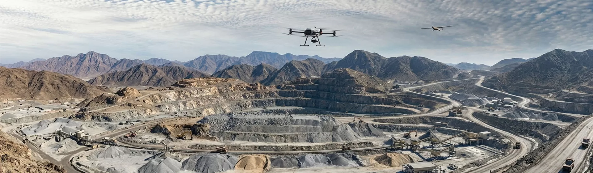
Today, professional drone technology has fundamentally transformed mining volumetric tracking. Instead of sending survey teams onto unstable stockpiles or steep excavation slopes, mining companies can capture engineering-grade 3D data safely, rapidly, and at significantly lower cost. High-resolution aerial mapping combined with advanced photogrammetry and LiDAR processing enables operators to monitor stockpile volumes, excavation progress, and cut-and-fill activities with unprecedented efficiency.
For mining companies seeking higher operational productivity and data-driven decision-making, drone-based volumetric tracking has become an essential component of modern digital mine management.
Why Drones Are Transforming Mining Volumetric Tracking
A drone is far more than an aerial camera. In mining applications, it serves as a highly accurate airborne 3D data acquisition platform capable of collecting georeferenced imagery and terrain information for detailed volumetric analysis.
Its value extends across four major areas.
Improving Worker Safety
Traditional surveying often requires personnel to climb unstable stockpiles, navigate steep embankments, or work beneath rockfall-prone slopes while carrying GNSS equipment. These environments present obvious safety risks.
Drone surveys eliminate the need for direct physical access. Operators remain in secure locations while the aircraft performs fully remote inspections, significantly reducing worker exposure to hazardous terrain.
Accelerating Survey Cycles
Conventional stockpile measurements can take several days to complete, especially across large mining sites.
With drones, the same survey can often be completed within 20 to 40 minutes. Captured data is uploaded directly into processing software, where automated photogrammetry generates 3D models and calculates stockpile volumes within hours instead of weeks.
This enables mining companies to conduct inventory assessments much more frequently and maintain near real-time visibility of material movement.
Increasing Inventory Accuracy
Estimating stockpile volumes through manual methods or sampling frequently results in substantial errors, sometimes exceeding 10%.
Drone mapping captures the complex geometry of irregular stockpile surfaces in exceptional detail. Using centimeter-level positioning and high-density point clouds, modern software can reduce volumetric errors to approximately 1%–3%, improving inventory management, financial reporting, and operational auditing.
Supporting Cut-and-Fill Analysis
Mining operations continuously reshape terrain through excavation, dumping, and backfilling.
By comparing 3D terrain models collected at different times, engineers can accurately determine how much material has been removed from a pit, added to a waste dump, or deposited into a tailings storage facility. This historical comparison supports production planning, contractor verification, environmental compliance, and project progress monitoring.
Essential Drone Capabilities for Mining Volume Measurement
Mining environments present unique operational challenges, including heavy dust, strong winds, uneven terrain, and electromagnetic interference. To deliver reliable engineering-grade results, drone systems must combine robust hardware with intelligent mapping software.
Hardware Requirements
| Capability | Why It Matters |
| RTK/PPK Centimeter-Level Positioning | Accurate positioning is the foundation of volumetric measurement. RTK or PPK technology ensures every captured image is tagged with centimeter-level geographic coordinates, preventing volume errors that could otherwise reach thousands of cubic meters. |
| Survey-Grade Mechanical Shutter Camera | Mechanical shutter cameras eliminate rolling shutter distortion during flight, preserving the geometric accuracy required for precise photogrammetry and volume calculations. |
| High Wind Resistance & Advanced Obstacle Avoidance | Mining sites frequently experience strong crosswinds and contain conveyors, power lines, machinery, and steep terrain. Multi-directional obstacle sensing combined with powerful flight control improves operational safety and mission reliability. |
Software and Data Processing Requirements
Terrain Following Flight
Mining sites rarely consist of flat ground. Intelligent terrain-following technology allows the drone to reference digital elevation models (DEM) and automatically adjust flight altitude as ground elevation changes.
Maintaining a consistent distance between the sensor and the terrain ensures uniform image resolution across the entire survey area, resulting in higher-quality reconstruction.
Intelligent Base Surface Calculation
Stockpiles are often built on slopes, within pits, or adjacent to retaining walls and industrial structures.
Professional mining software must support custom boundary selection and irregular base surface modeling, allowing users to exclude surrounding terrain and calculate only the true stockpile volume.
High-Density Point Cloud and 3D Modeling
Using photogrammetry or LiDAR, modern drone software automatically generates:
Dense 3D point clouds
Digital Surface Models (DSM)
Digital Elevation Models (DEM)
High-resolution 3D mesh models
These outputs provide engineers with accurate terrain representations for volumetric calculations, progress monitoring, planning, and documentation.
Recommended Drone Solutions for Different Mining Scenarios
Different mining environments require different aerial platforms. Selecting the appropriate drone depends largely on survey scale, operational frequency, and GPS availability.
RTK Multirotor Drones for Daily Stockpile Surveys
For routine inventory management in quarries and small to medium-sized open-pit mines, lightweight RTK multirotor drones remain the industry's preferred solution.
Their portability, rapid deployment, vertical takeoff capability, and high mapping accuracy make them ideal for frequent stockpile measurements and production monitoring.
VTOL Fixed-Wing Drones for Large Mining Operations
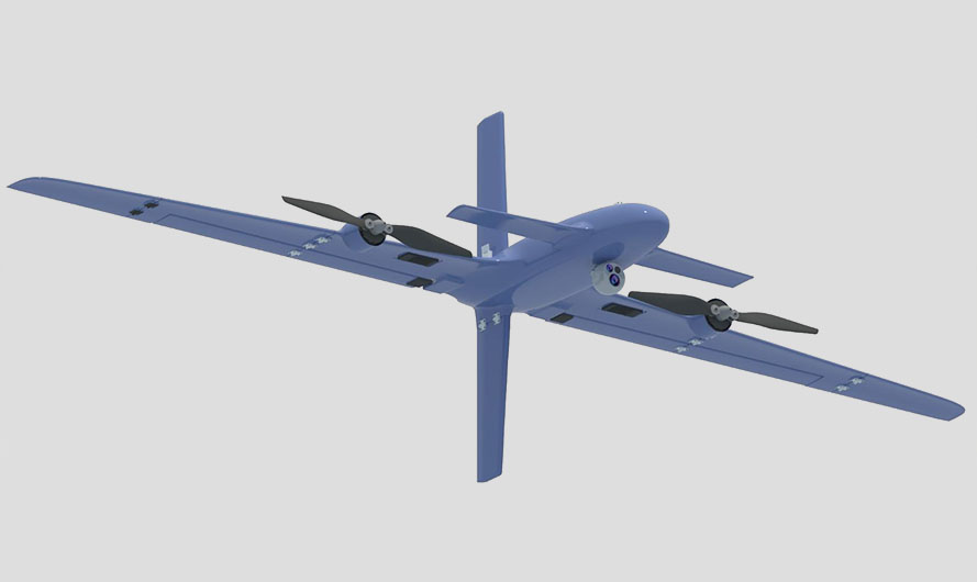
Massive open-pit mines and regional tailings facilities often cover several square kilometers, making multirotor aircraft less efficient.
The ZAi Hybrid VTOL Drone Series from HongKong Global Intelligence Technology Group Limited combines the vertical takeoff flexibility of a multirotor with the long-range efficiency of a fixed-wing aircraft. With flight endurance measured in hours rather than minutes, these drones can efficiently survey expansive mining concessions during a single mission.
Their extended coverage makes them particularly suitable for:
Large-scale earthwork calculations
Pit expansion monitoring
Tailings dam inspections
Long-distance corridor mapping
Multi-site mining operations
AI-Powered Autonomous Drone Systems
Many mining companies are moving toward fully automated surveying workflows.
HongKong Global Intelligence Technology Group Limited provides customized autonomous drone solutions that integrate AI-powered visual navigation with Drone-in-a-Box systems.
These platforms can:
Perform scheduled autonomous flights
Automatically inspect stockpiles
Upload survey data to cloud platforms
Process volumetric reports automatically
Return to the docking station for charging without human intervention
This approach enables unattended, high-frequency inventory monitoring while significantly reducing labor costs and improving operational consistency.
SLAM-Based LiDAR Drones for Underground Mining
GPS signals disappear inside underground mines, tunnels, stopes, processing plants, and enclosed storage facilities.
For these environments, HongKong Global Intelligence Technology Group Limited offers customized SLAM-based drone solutions.
Instead of relying on satellite positioning, these aircraft use Simultaneous Localization and Mapping (SLAM) technology together with LiDAR sensors to continuously map their surroundings while navigating independently.
SLAM drones can safely enter underground stopes, ore passes, tunnels, and enclosed storage silos to generate highly accurate 3D models and calculate internal material volumes that would otherwise be extremely difficult—or dangerous—to measure manually.
Choosing the Right Drone for Mining Volumetric Tracking
There is no single drone platform that fits every mining operation.
For routine stockpile monitoring in small and medium-sized open-pit mines, portable RTK multirotor drones remain the global standard because they combine high accuracy with operational simplicity. Large mining enterprises covering vast areas increasingly favor VTOL fixed-wing drones capable of surveying multiple square kilometers in one flight. Underground mines, enclosed storage facilities, and GPS-denied environments require SLAM-enabled LiDAR drones to achieve accurate volumetric measurements safely.
With extensive expertise in industrial UAV development, manufacturing, and customized drone solutions, HongKong Global Intelligence Technology Group Limited delivers complete mining drone systems tailored to specific operational requirements. Whether your project involves daily inventory management, large-scale earthwork analysis, autonomous inspection, or underground 3D mapping, our engineering team can help design a solution that improves safety, enhances accuracy, and supports more efficient mining operations. Contact our specialists to discuss a customized mining volumetric tracking solution for your site.

 English
 français
 Deutsch
 русский
 فارسی
فارسی ไทย
ไทย العربية
 Nederland
 বাঙালি
 Македонија