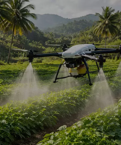
Modern construction, infrastructure, mining, energy, and land development projects generate massive amounts of information every day. Yet one of the greatest challenges is not collecting data—it's transforming that data into clear, measurable progress that project teams, investors, owners, and regulators can all understand.
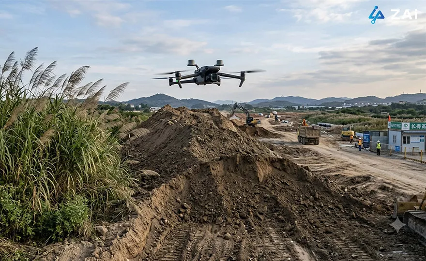
This is where Surveying & Mapping drones have become indispensable. Rather than serving only as aerial mapping tools, today's UAVs function as intelligent digital data acquisition platforms, continuously capturing site conditions and converting them into actionable progress reports, digital twins, and collaborative project dashboards.
As an industrial drone manufacturer, HongKong Global Intelligence Technology Group Limited provides customized enterprise drone solutions that integrate UAV hardware, precision positioning technologies, advanced sensors, and cloud-based analytics to help organizations monitor project progress with greater accuracy, efficiency, and confidence.
Why Drone-Based Progress Tracking Is Transforming Surveying & Mapping
Traditional progress monitoring often depends on manual inspections, field surveys, photographs, spreadsheets, and fragmented reporting. These methods are labor-intensive, inconsistent, and often fail to provide an objective view of site conditions.
Surveying drones fundamentally change this workflow by creating repeatable, high-resolution digital records throughout the project lifecycle.
Instead of isolated site visits, organizations gain continuously updated digital representations of the entire project, enabling stakeholders to compare progress over time, identify deviations early, and make informed decisions based on measurable evidence.
A complete drone-based workflow typically supports:
4D timeline visualization
Earthwork and stockpile measurement
BIM and CAD comparison
Digital twin generation
Interactive stakeholder reporting
Quality assurance and as-built verification
Compliance documentation
Multi-team collaboration
The result is a single source of truth that connects field operations with project management.
1. 4D Timeline Visualization: Watching Projects Evolve Over Time
One of the most valuable capabilities of modern Surveying & Mapping drones is the creation of time-based digital records.
By flying identical autonomous missions on a weekly or monthly schedule, UAVs capture high-resolution orthomosaics, digital surface models, and dense point clouds from exactly the same viewpoints.
These datasets can then be stacked chronologically to produce an interactive 4D timeline.
Project managers can simply move a timeline slider to compare:
Week-to-week construction progress
Monthly earthwork development
Structural installation milestones
Road and utility expansion
Site preparation stages
Instead of reviewing hundreds of photographs, stakeholders immediately visualize how the project has evolved.
This dramatically improves communication between contractors, owners, consultants, and investors while reducing misunderstandings regarding actual project status.
2. Automated Earthwork Measurement and Volume Tracking
Construction and mining projects frequently require continuous monitoring of excavation volumes, embankments, stockpiles, and material inventories.
Traditional measurements using total stations or manual surveying require significant labor and often interrupt site operations.
Modern enterprise drone solutions automate this entire process.
Using high-resolution imagery together with DEM and DSM models, UAV software automatically calculates:
Cut and fill quantities
Stockpile volumes
Material inventories
Excavation progress
Terrain changes
Earthmoving efficiency
Reports that once required several days of field measurements can now be generated within minutes after data processing.
For organizations managing multiple active construction sites, this translates directly into better resource allocation and more accurate project forecasting.
3. BIM and CAD Comparison for Construction Verification
Progress reporting becomes significantly more valuable when actual site conditions can be compared directly against engineering designs.
Drone-generated 3D models can be accurately aligned with:
CAD drawings
BIM models
Engineering plans
Design surfaces
Utility layouts
This overlay allows project teams to quickly identify:
Areas progressing ahead of schedule
Construction delays
Dimensional deviations
Boundary encroachments
Elevation inconsistencies
Potential rework risks
Rather than discovering issues during final inspections, managers receive early visual evidence, allowing corrective actions before costly errors accumulate.
For large infrastructure projects, this capability greatly improves quality management while reducing schedule overruns.
Build a Progress Monitoring Workflow That Fits Your Project
Every project has unique operational requirements, terrain conditions, reporting standards, and data integration needs. Whether you are managing infrastructure construction, mining operations, industrial facilities, renewable energy sites, or large-scale land development, HongKong Global Intelligence Technology Group Limited can design customized enterprise drone solutions tailored to your workflow.
Our specialists can recommend the appropriate UAV platform, RTK/PPK positioning system, payload configuration—including LiDAR drone options where vegetation penetration or complex terrain mapping is required—and the software ecosystem needed to automate Progress Tracking & Stakeholder Reporting from data capture through cloud delivery.
4. Multi-Stakeholder Reporting Through Interactive Digital Platforms
Project reporting is no longer limited to static PDF documents.
Modern drone platforms generate interactive deliverables that can be securely shared with stakeholders anywhere in the world.
Deliverables may include:
Orthomosaic maps
3D mesh models
Dense point clouds
360° panoramic walkthroughs
Interactive web viewers
Measurement-enabled cloud portals
Different stakeholders benefit in different ways.
Project Owners and Investors
Non-technical stakeholders can clearly understand project status without requiring GIS or surveying expertise.
Interactive 3D visualizations communicate progress far more effectively than spreadsheets or written reports.
Contractors and Engineering Teams
All project participants work from identical datasets, minimizing conflicting interpretations while improving collaboration across multiple disciplines.
Government Agencies and Regulatory Authorities
Drone-generated datasets include precise timestamps and georeferenced information, simplifying compliance reviews, environmental assessments, and project acceptance procedures.
Essential Features for Professional Progress Tracking Drones
Reliable progress monitoring requires much more than simply flying a UAV.
Professional surveying platforms should include several critical capabilities.
RTK and PPK Positioning
Centimeter-level positioning ensures that every repeated survey aligns perfectly with previous missions, eliminating coordinate shifts and improving temporal comparison accuracy.
Repeatable Autonomous Flight Planning
Waypoint missions, terrain-following routes, and automatic mission replay guarantee consistent image overlap, flight altitude, and camera angles throughout the entire project lifecycle.
Terrain Following
Automatic terrain adaptation maintains consistent Ground Sampling Distance (GSD), even across uneven landscapes, producing more reliable measurements.
Intelligent Obstacle Avoidance and Rugged Design
Construction environments can be unpredictable.
Enterprise UAVs equipped with omnidirectional obstacle sensing together with IP45 or IP55 protection operate more safely in dusty, windy, or light-rain conditions.
Rapid Data Processing and Cloud Connectivity
Modern workflows increasingly support onboard processing or direct cloud synchronization through 4G and 5G networks, enabling same-day mapping and reporting for faster decision-making.
Recommended Hardware Configuration
A complete Progress Tracking & Stakeholder Reporting solution combines reliable UAV hardware with high-precision surveying equipment.
Typical hardware includes:
RTK or PPK-enabled UAV platform
High-resolution mechanical shutter mapping camera
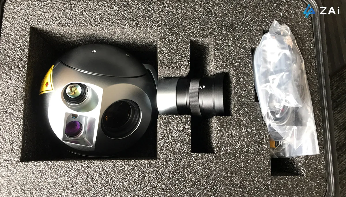
Optional LiDAR drone payload for vegetation penetration and terrain extraction
Intelligent Ground Control Points (GCPs)
RTK base station or network correction services
Smart ground station
5G communication gateway for rapid cloud uploads
The appropriate platform depends on project scale.
Compact RTK multirotor drones provide fast deployment for building sites and urban projects, while VTOL fixed-wing systems are ideal for long corridors, mining operations, and large infrastructure developments where maximum coverage and endurance are required.
Software Ecosystem for End-to-End Project Reporting
An efficient drone solution integrates field operations with office processing and cloud collaboration.
The software workflow generally consists of three stages.
Flight Planning
Mission planning software automates flight routes, image overlap, terrain following, and repeat missions to ensure consistent data acquisition.
Photogrammetry Processing
Captured imagery is converted into orthomosaics, DEMs, DSMs, point clouds, and detailed 3D models using professional photogrammetry software.
Enterprise Reporting Platform
Cloud-based reporting platforms combine drone data with project management systems to generate dashboards, earthwork calculations, PDF reports, AI-assisted progress analysis, and stakeholder portals that support collaborative decision-making.
This integrated workflow enables engineering teams to move seamlessly from data collection to actionable insights.
Why Customized Enterprise Drone Solutions Matter
No two surveying projects are identical.
Factors such as project size, terrain complexity, vegetation coverage, reporting frequency, regulatory requirements, and existing software infrastructure all influence the optimal UAV solution.
From selecting the right Surveying & Mapping drones and LiDAR drone configurations to integrating RTK positioning, cloud reporting platforms, digital twin workflows, and stakeholder collaboration systems, our team works closely with clients to develop scalable solutions that match real operational requirements.
If your organization is planning to improve Progress Tracking & Stakeholder Reporting, automate construction monitoring, enhance surveying efficiency, or build a comprehensive digital project management workflow, contact HongKong Global Intelligence Technology Group Limited. Our specialists can design a customized UAV surveying and mapping solution that aligns with your project objectives, operational environment, and long-term digital transformation strategy.
Technical Consultation & Project Requirements
Share your mission specifications—such as payload capacity, endurance needs, or environmental constraints. Our engineering team will review your data and provide a optimized UAV configuration tailored to your industrial workflow.
HongKong Global Intelligence Technology Group Limited
 English
 français
 Deutsch
 русский
 فارسی
فارسی ไทย
ไทย العربية
 Nederland
 বাঙালি
 Македонија