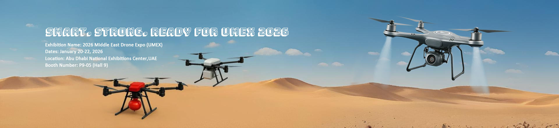
Product Description
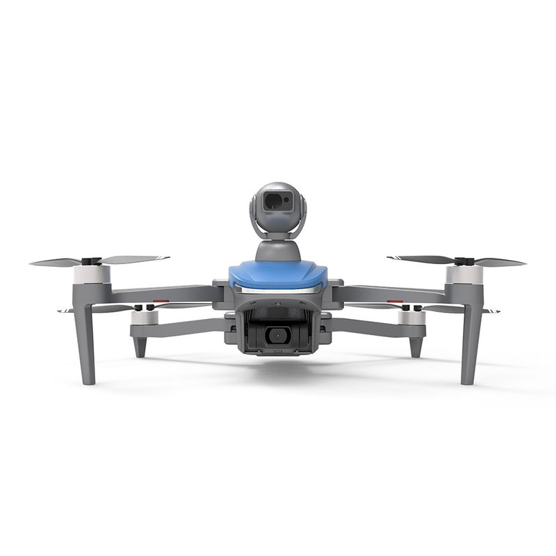
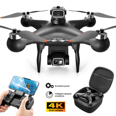
This professional drone with camera is a professional aerial measurement and photogrammetry drone designed to provide accurate and reliable aerial survey data for efficient and cost-effective survey applications. The professional drone is equipped with satellite positioning systems such as GPS/GLONASS and it features a maximum ascend speed of 4m/s, take-off weight of about 3178g, wheelbase for foldable operation, and global 4G image transmission with unlimited distance for extended aerial imaging. The Aerial Survey obstavle avoidance Drone is great for applications and other aerial measurement tasks.
Technical Parameters
| Attributes |
Technical Parameters |
| Flight Control |
Compatible with Mavlink Protocol Flight Control |
| 4G Extended Image Transmission |
Global 4G Image Transmission, Unlimited Distance |
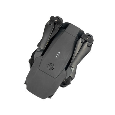
| Wheelbase |
Foldable |
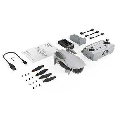
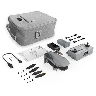
| Battery |
3000mAh |
| Maximum Speed |
17m/s |
| Gimbal |
Two Axis |
| Screen Type |
LCD |
| Operating Temperature Range |
-5-40℃ |
| Take Off Weight |
About 3178g |
| Flight Time |
40mins(no Load),29mins(Full Load) |
Product Advantages
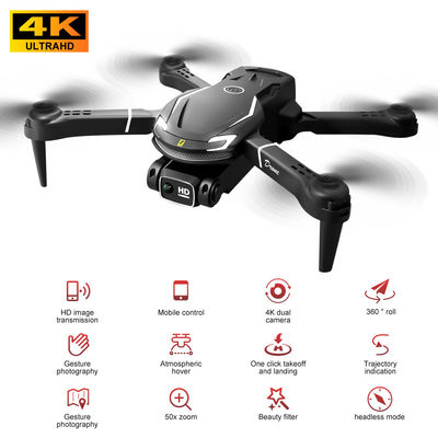
1. Equipped with rotatable lidar which can detect obstacles around
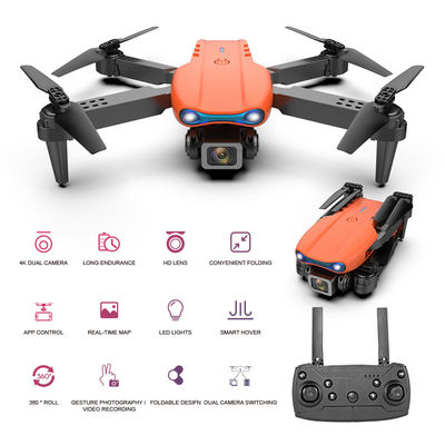
2. 4K movie grade HD image,8 megapixel, incisive texture
3. 3km image transmission, low latency, strong anti-interference
4. 27 mins flight time,level-5 strong wind-resistance
5. Delay photography function, easy to use
6. 3-axis brushless gimbal supports horizontal and vertical shooting
7. With a key return, low battery return, runaway return, and other intelligent flight modes. when the flight occurs abnormally, the aircraft will automatically return to flight.
8. Working modes: follow me, circle, rocket, dronie, helix, boomerang, flight point, flight route
Product Application
1. Travel/adventure /selfie: Record the beautiful scenery of the great rivers and mountains, and the beautiful pictures under the flying camera, which are vast and magnificent.
2. Urban aerial photography: Modern cities are full of tall buildings and crisscrossed streets. Aerial photos taken from high places and far away can better the prosperity and magnificence of the city with neonates.
3. Commercial aerial photography: 4K Ultra HD image quality can better meet the needs of commercial shooting.
4. Patrol /forest protection /dangerous patrol: Equipped with an ultra-high-definition camera, the PTZ angle is adjustable, and the field of view is controlled by you. lt can collect images of farmland and orchards in real time and quickly plan the operation routes of field and mountain orchards.

FAQ
Q: Are you a manufacturer or trade company?
A: We are the manufacturer.
Q: Do you accept customization?
A: Yes, we accept customization both on software & hardware and logo branding, color boxes, as well as packaging.
Q: What is your warranty policy?
A: One-year warranty, replacement, or repair services shall be provided under non-artificial quality issues.
Q: What's your MOQ?
A: Our MOQ is 1000pcs, trial orders, and samples are also available.
Q: How about the lead time and delivery time?
A: The stocked sample shall be sent out within 1-3 days after payment is received if the model is stocked
The lead time for mass quantities will be sent out within 30-35 days.
Delivery time : 3-7 days to arrive at destination after delivery if sent by international express like DHL, UPS, FedEx, etc.
Sea Transportation: 25-30 days after sailing
Q: How long does it take for the Infrastructure Inspection Drone to be delivered?
A: The Infrastructure Inspection Drone will be delivered within 3-7 work days.
Q: Do you provide SKD service?
A: Yes, we can do SKD orders, if your company can assemble yourself, the MOQ is 1000pcs
Q: What is the Supply Ability for the Infrastructure Inspection Drone?
A: The Supply Ability for the Infrastructure Inspection Drone is 100,000 pcs per month.
Q: Where are the drones shipped from?
A: We send drones from our Shenzhen factory, or we can send them from Vietnam and the Philippines.
Q: Do you provide any value-added services for particular purposes?
A: We can dispatch our professional engineers to your company for drone assembly if your order quantity reaches our requirements.