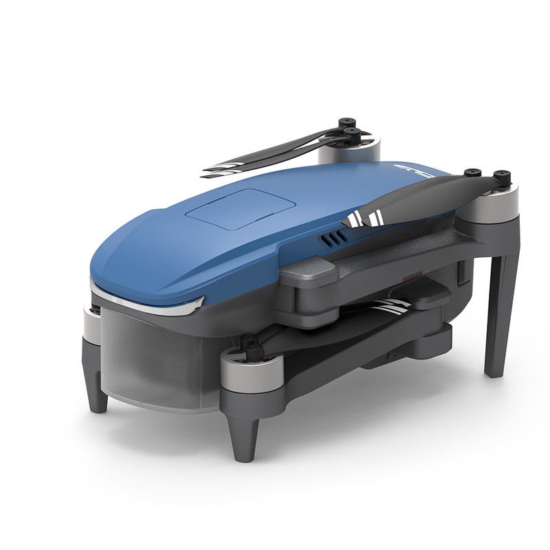
| 1 aircraft |
|
Dimensions (including obstacle avoidance module, excluding
paddle) |
Expansion: length 186 × width 258 × height 112 mm
Folded: length 167 × width 97 × height 112 mm |
| Diagonal wheelbase |
280mm |
Weight (including battery, propeller and avoidance
fault module) |
500 g (with three-axis gimbal) |
| maximum ascent speed |
4m/s (sports gear)
3m/s (normal speed)
3.5m/s (return mode) |
| maximum descent speed |
3m/s (sports gear)
2m/s (normal speed)
3m/s (return mode) |
| maximum horizontal flight speed |
14m/s (sports gear)
10m/s (normal speed)
12m/s (return mode) |
| Maximum flight altitude |
4000m |
| longest flight time |
27 minutes |
| Working temperature |
0°C to 40°C |
| Satellite positioning module |
GPS/GLONASS dual mode |
| Hover accuracy |
Vertical: +/- 0.5 meters
± 0.2 m (when optical flow positioning and ultrasonic height fixing are working normally)
Level: +/- 1.5 meters
± 0.3 m (when optical flow positioning is working normally) |
| working frequency |
5.8GHz |
| flight altitude |
Default 120 meters, maximum 500 meters (must manually change APP settings) |
| 2 Optical flow positioning system |
|
| Optical flow positioning system |
have |
| Usage environment |
The surface has rich texture and sufficient lighting conditions (>15 lux, normal indoor fluorescent lighting environment) |
| Speed measurement range |
Flight speed ≤ 1.5m/s (height 2 meters, sufficient light) |
| effective height |
0.5 ~6 meters |
| 3 Ultrasonic height-fixing system |
|
| Ultrasonic height setting system |
have |
| Usage environment |
Except for water surfaces or floors made of absorbing materials (such as thick carpets) |
| Speed measurement range |
Flight speed ≤ 3m/s |
| Height measurement range |
0.05 ~4.5 meters |
| 4 Obstacle avoidance system (optional) |
|
| Obstacle avoidance type |
Two-axis laser |
| Obstacle avoidance direction |
540°, front, back, left, right, up |
| Maximum detection distance |
20m |
| Maximum obstacle avoidance speed |
10m/s |
| 5 three-axis gimbal |
|
| stabilization method |
Mechanical stabilization of brushless motors |
| Controllable rotation range |
Pitch: -90° to 0° (default setting) -90° to 20° (extended setting) |
| stable system |
Three axes (pitch +35/-125°, roll ±35°, direction ±30°) |
| 6 Camera specifications |
|
| image sensor |
Sony Sensor CMOS |
| photo size |
3840x2160 (8 million) |
| Photo shooting mode |
Single shooting, continuous shooting, time-lapse shooting |
| Record video maximum resolution |
3840×2160 (4K) 15FPS, 2716×1524 (2.7k) 25FPS |
| Maximum bit rate for recording video |
25Mbps |
| Support file system |
FAT32 |
| Image Format |
JPEG |
| video format |
MP4 |
| Supported memory card types |
MicroSD card, supports up to 128GB, Micro SD card with transfer speed reaching c10 rating. |
| Working temperature |
0°C to 40°C |
| 7 flight batteries |
|
| capacity |
3000mAh |
| Voltage |
11.4V |
| Battery Type |
LiPo 3S |
| energy |
29.64 Wh |
| Overall battery weight |
About 170g |
| Working temperature |
0°C to 40°C |
| Maximum charging power |
29W |
| Charging time |
< 4h (using 5V 2A power adapter) |
| 8 APP/image transmission |
|
| Mobile App |
CFLY 2 |
| Real-time image transmission |
Maximum 720P, will automatically switch the resolution according to environmental conditions |
| Maximum image transmission distance |
3000m |
| Aerial photography mode |
Fading away mode, surround mode, skyrocketing mode, spiral mode |
| Mobile phone system version requirements |
Andriod 6.0 or above, IOS 10.0 or above |
| 9 charger |
|
| enter |
5V 2A (recommended, the power of the power adapter determines the charging time) |
| output |
4.35V 0.7A×3 |
| rated power |
10 W |
| 10 remote control |
|
| working frequency |
5.8GHz |
| Maximum signal effective distance |
3000m |
Equivalent isotropic radiated power
(EIRP) |
<26 dBm (FCC),
<20 dBm (CE/SRRC/MIC) |
| Working current |
700mA |
| Mobile device holder |
Thickness 6.5-8.5 mm, maximum length 80 mm |
| battery capacity |
2600 mAh |
| Length of use |
2.5h (different mobile phones will vary) |
| battery voltage |
3.7V |
| Battery type |
LiPo 18650 |
| Battery energy |
9.62 Wh |
| Working temperature |
0°C to 40°C |
| Charging method |
USB |
| Maximum charging power |
10W |
| Charging time |
< 2.5h (It is recommended to use a 5V 2A power adapter, its power determines the charging time) |