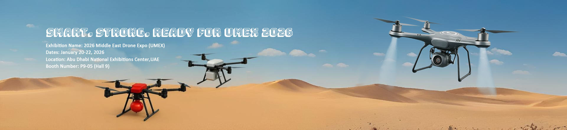
Highlight:
Professional Drones
, Drone with Thermal Camera
, Survey Drones
Name: |
Faith Mini Drone |
Maximum Distance: |
1080P 10km |
Gimbal: |
3-axis |
Battery: |
3000mAh |
Satellite Positioning Systems: |
GPS/GLONASS |
Maximum Ascend Speed: |
4m/s |
Maximum Decsend Speed: |
3m/s |
Wheelbase: |
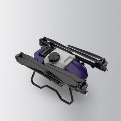
Foldable |
Maximum Speed: |
17m/s |
Max Service Ceiling Above Sea Level: |
4000m |
Flight Time: |
40mins(no Load) ,29mins(full Load) |
4G Extended Image Transmission: |
Global 4G Image Transmission, Unlimited Distance |
Flight Control: |
Compatible With Mavlink Protocol Flight Control |
Operating Temperature Range: |
-5-40℃ |
Take Off Weight: |
About 3178g |
Screen Type: |
LCD |
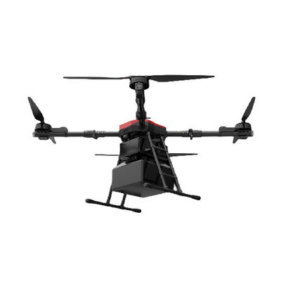
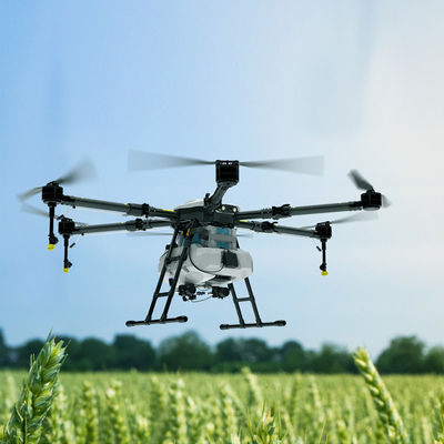
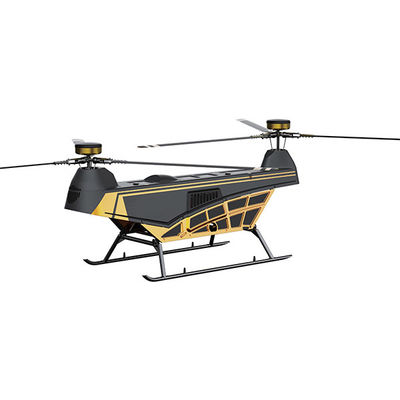
ZAi Professional Survey Drones with 3-axis Gimbal 4K Thermal Camera 2T UAV Drone
Drone Specification
| 1. |
Aircraft |
Faith 2 Pro |
Note |
|
Size |
Unfold: 191 X 262 X 107 mm ( L*W*H)
Fold: 179X 108 X 74 mm ( L*W*H) |
|
|
W heelbase |
280 mm |
|
|
Weight (Battery & Propellers Included) |
562g |
|
|
Max Ascent Speed |
4m/s(sport mode)
3m/s(Normal mode) |
|
|
Max Descent Speed |
3m/s(sport mode)
2m/s(Normal mode) |
|
|
Max Speed |
14m/s(sport mode)
10m/s(Normal mode) |
|
|
Max Service Ceiling Above Sea Level |
4000 m |
|
|
Max Flight Time |
32 mins |
|
|
Operating Temperature Range |
﹣ 5°C~45°C |
|
|
Satellite Positioning Systems |
GPS/GLONASS |
|
|
Hover Accuracy Range |
vertical: +/- 0.5 m
± 0.2 m (ultrasonic system, optical flow system works)
horizontal: +/- 1.5m
± 0.3 m (ultrasonic system, optical flow system works) |
|
|
Operating Frequency |
2.4GHz |
|
 |
Maximum flight height |
120m |
|
| 2. Optical flow system |
|
Optical flow system |
yes |
|
|
Operating Environment |
Surface with clear pattern and adequate lighting (lux > 15) |
|
|
Velocity Range |
≤ 1.5 m/s at 6.6 ft (2 m) above ground |
|
|
Altitude Range |
0.5~5m |
|
| 3. Ultrasonic altitude system |
|
Ultrasonic altitude system |
yes |
|
|
Operating Environment |
except for the surface of water or ground of absorbing material (such
as thick carpet) |
|
|
Velocity Range |
≤ 3m/s |
|
|
Altitude Range |
0.2~4.5m |
|
| 4. 3-axis gimbal |
|
Stabilization |
3-axis (pitch:+30/- 120° ,roll:± 30° ,course:±30°) |
|
|
Controllable Range |
pitch:-90°~20° |
|
|
Jitter Amount |
0.01° |
|
| 5. Normal camera |
|
Sensor |
SONY CMOS; |
|
|
Image Size |
3840*2160 (8mp) |
|
|
Video Recording Resolution |
2716×1524 (2.7k) 25FPS |
|
|
Supported File Systems |
FAT32(<=32GB) /exFAT(>32GB) |
|
|
Video |
MP4 |
|
|
Operating Temperature Range |
0°C~40°C |
|
| 6. Thermal imaging infrared camera |
|
Sensor |
Vanadium oxide uncooled infrared focal plane detector; |
|
|
Zoom |
4.3mm |
|
|
Sensor resolution |
256×192 @25Hz |
|
|
Infrared temperature measurement
accuracy [1] |
±2C or ±2% |
|
|
Measuring range |
Industrial temperature measurement: - 15 C~ 150 C (high image
quality) 50 C~550 C (wide range) |
|
|
Digital zoom |
8x |
|
|
Effective measurement distance (person) |
about 150m |
|
|
Pixel spacing |
12 μm |
|
|
Wavelength range |
8- 14 μm |
|
|
Photo Format |
R-JPEG |
|
|
Video Format |
MP4 |
|
|
Temperature measurement method |
Point temperature measurement, Regional temperature
measurement |
|
|
Focusing mode |
Non-thermal prime lens |
|
|
Support for file systems |
FAT32 |
|
|
Support for storage card types |
MicroSD card, with a maximum support of 128GB and a
the transmission speed of UHS-I Speed Grade 3 rated Micro SD card. |
|
| 7. Battery |
|
Capacity |
3000mAh |
|
|
Voltage |
1 1.4V |
|
|
Battery Type |
LiPo 3S |
|
|
Energy |
35.34 W h |
|
|
Net Weight |
196 g |
|
|
Charging Temperature Range |
﹣ 5°C~45°C |
|
|
Max charging power |
35 W |
|
|
charge time |
<5h(with 5V 2A adapter) |
|
|
| 8. APP |
|
Mobile App |
C-Fly Go |
|
|
Maximum FPV transmission distance |
10km |
|
|
Resolution |
1080P |
|
|
Required Operating Systems |
Android 6.0 above, IOS 10.0above |
|
|
| 9. Charger |
| Input |
5 V 2A(recommend) |
|
| Output |
4.35V 0.7A×3 |
|
|
| 10. Remote Controller |
| Operating Frequency |
2.4GHz |
|
| Screen type |
LCD |
|
| Screen size |
5.5inch |
|
| Resolution |
1080P |
|
| maximum transmission distance |
10 km |
|
| EIRP |
<26 dBm (FCC) ,<20 dBm (CE/SRRC/MIC) |
|
| Usage time |
about 4h |
|
| Operating Temperature Range |
﹣ 5°C~45°C |
|
| Charger way |
USB-C |
|
Description
The ZAi Professional Survey Drones, also known as SAR drones, are unmanned aerial vehicle (UAV) specifically designed and equipped to assist in search and rescue operations. These UAV drones are utilized to locate and provide aid to individuals in distress or in emergency situations. They are equipped with advanced sensors, cameras, and communication systems to enhance their capabilities for effective search and rescue missions.
Search and Rescue Drones are typically equipped with high-resolution cameras, including thermal imaging cameras, to aid in locating missing persons or individuals in difficult-to-reach areas. The cameras of the survey drones provide real-time video feeds and still images that can be analyzed by rescue teams to identify the location and condition of the individuals in need of assistance.
These UAV drones are often equipped with GPS systems and autonomous flight capabilities, allowing them to navigate autonomously or follow pre-defined routes. They can cover large areas quickly and efficiently, reducing the time and resources required for manual search operations. Additionally, obstacle avoidance sensors and advanced flight control algorithms enhance their ability to maneuver safely in challenging environments.
Product Strength
- Thermal imaging
- Drone:0.56kg/280mm/foldable
- Battery:3000mAh 3S,11.4v,0.2kg
- the flight distance is 10km, flight time 30mins
- 2.7K 25 FPS/8mp
- support 4G
- 3-axis brushless motor gimbal
Product Features
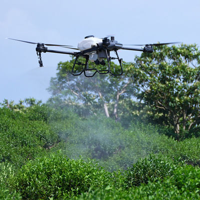
- High-resolution Cameras: Search and Rescue Survey Drones are equipped with high-resolution cameras, including thermal imaging cameras, to capture detailed images and videos of the search area. These cameras of the thermal drones provide visual data that aids in locating individuals in distress, even in low-light or adverse weather conditions.
- Autonomous Flight Capability: These drones UAV often have autonomous flight capabilities, allowing them to navigate and conduct search operations without constant manual control. They can follow pre-programmed flight paths or use advanced GPS systems to cover large areas efficiently.
- Advanced Sensors: The Search and Rescue Thermal Drones are equipped with advanced sensors such as obstacle avoidance sensors, altitude sensors, and GPS systems. These sensors enhance the drone's ability to detect and avoid obstacles, maintain stable flight, and accurately navigate the search area.
Product Application
- Natural Disasters: Search and Rescue Drones are deployed in natural disaster scenarios such as earthquakes, hurricanes, floods, or avalanches to locate and assist individuals trapped or in need of rescue. They can access remote or dangerous areas and provide real-time information to rescue teams.
- Wilderness Search and Rescue: SAR drones are used in wilderness settings, such as forests, mountains, or remote areas, to aid in locating lost or injured hikers, campers, or climbers. The drones can cover large areas quickly, providing valuable visual data for search teams.
- Urban Search and Rescue: In urban environments, such as collapsed buildings or disaster-stricken areas, SAR drones play a crucial role in search and rescue operations. They can navigate through debris, assess structural integrity, and assist in locating survivors or victims.
FAQ
Q: Are you a manufacturer or trade company?
A: We are the manufacturer.
Q: Do you accept customization?
A: Yes, we accept customization both on software & hardware and logo branding, color boxes, as well as packaging.
Q: What is your warranty policy?
A: One-year warranty, replacement, or repair services shall be provided under non-artificial quality issues.
Q: What's your MOQ?
A: Our MOQ is 1000pcs, trial orders, and samples are also available.
Q: How about the lead time and delivery time?
A: The stocked sample shall be sent out within 1-3 days after payment is received if the model is stocked
The lead time for mass quantities will be sent out within 30-35 days.
Delivery time : 3-7 days to arrive at destination after delivery if sent by international express like DHL, UPS, FedEx, etc.
Sea Transportation: 25-30 days after sailing
Q: How long does it take for the Infrastructure Inspection Drone to be delivered?
A: The Infrastructure Inspection Drone will be delivered within 3-7 work days.
Q: Do you provide SKD service?
A: Yes, we can do SKD orders, if your company can assemble yourself, the MOQ is 1000pcs.
Q: What is the Supply Ability for the Infrastructure Inspection Drone?
A: The Supply Ability for the Infrastructure Inspection Drone is 100,000 pcs per month.
Q: Where are the drones shipped from?
A: We send drones from our Shenzhen factory, or we can send them from Vietnam and the Philippines.
Q: Do you provide any value-added services for particular purposes?
A: We can dispatch our professional engineers to your company for drone assembly if your order quantity reaches our requirements.